The planned liftoff Thursday of an Indian Geosynchronous Satellite Launch Vehicle with a geostationary Earth-imaging satellite has been postponed due to technical reasons, India’s space agency announced.
The Indian Space Research Organization did not identify the reason for the launch postponement. ISRO said Wednesday that a “revised launch date will be informed in due course.”
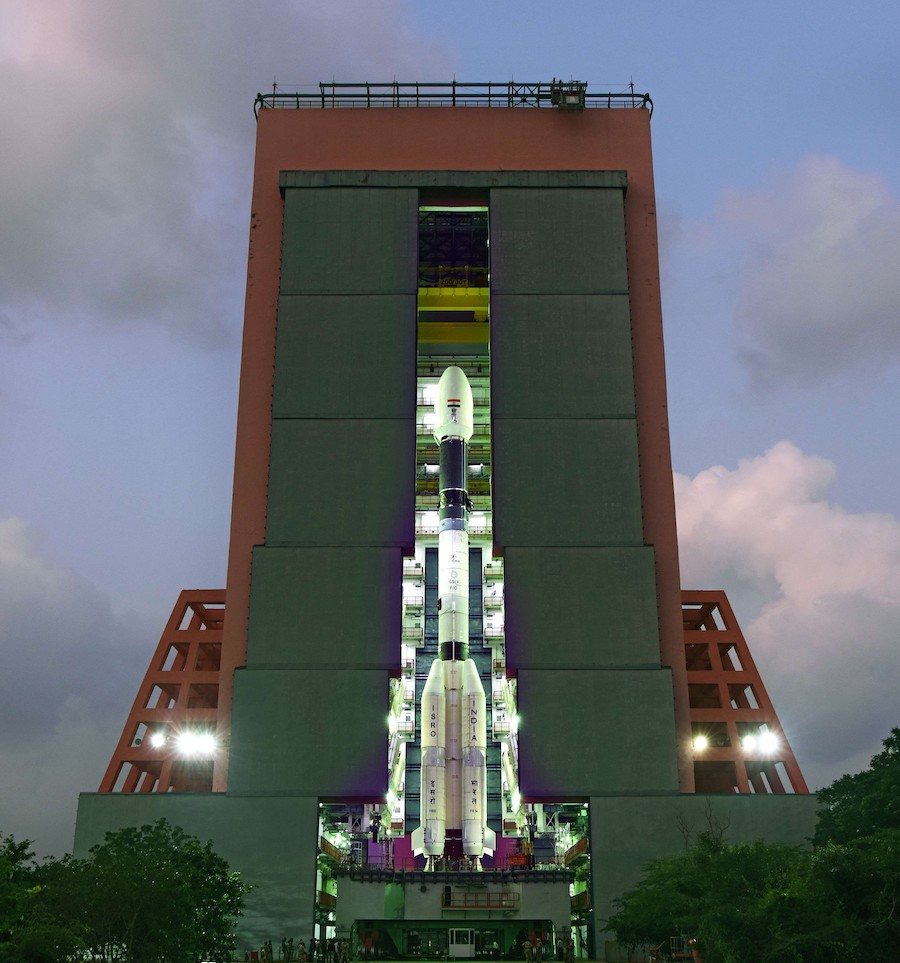
The GSLV Mk.2 launcher was scheduled for liftoff at 1213 GMT (7:13 a.m. EST) Thursday from the Satish Dhawan Space Center on India’s east coast.
When it takes off, the 169-foot-tall (51.7-meter) GSLV Mk.2 launcher will head toward the southeast from the space center over the Bay of Bengal. Less than 20 minutes later, the GSLV’s third stage will deploy India’s Geo Imaging Satellite 1, or GISAT 1, into an elliptical geostationary transfer orbit.
The GSLV mission, designed GSLV-F10, will be India’s first space launch of the year. The launch vehicle set to launch with GISAT 1 features an enlarged 13.1-foot (4-meter) diameter composite nose shroud, giving the GSLV Mk.2 additional volume for payloads.
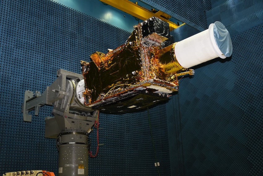
The 5,000-pound (2,268-kilogram) GISAT 1 spacecraft will use its on-board propulsion system to reach a circular geostationary orbit more than 22,000 miles (nearly 36,000 kilometers) over the equator. Satellites in geostationary orbit fly around Earth at the same rate as the planet’s rotation, giving spacecraft a constant view of the same part of Earth.
Most Earth observation satellites orbit at much lower altitudes — typically a few hundred miles above Earth — but have narrow coverage swaths. GISAT 1 will be positioned in geostationary orbit at 85.5 degrees east longitude, providing views of the Indian subcontinent and neighboring ocean regions 24 hours per day.
Weather monitoring satellites also fly in geostationary orbit, but GISAT 1 carries a powerful Earth-viewing telescope to provide sharper imagery than a typical meteorological observatory.
Three color and hyperspectral sensors will take visible, near-infrared and shortwave infrared images. The hyperspectral detectors are designed to register details about landscapes and oceans, such as vegetation type, plant health, water quality and other environmental factors.
“Imagery from GISAT 1 will be utilized for a host of applications including crop monitoring at regional and national levels, drought progression and assessment, ocean and coastal zone management, fog detection and warning, disaster management, dust monitoring, and many more,” ISRO said.
GISAT 1 will use its telescope to scan in east-west and north-south motions, collecting images with a ground resolution as sharp as about 137 feet (42 meters).
The GISAT 1 spacecraft is designed for a lifetime of at least seven years.
Email the author.
Follow Stephen Clark on Twitter: @StephenClark1.