The satellite awaiting launch early Saturday from California aboard the final flight of the venerable Delta 2 rocket should allow scientists to more precisely track changes in our planet’s ice sheets, using six green laser beams to chart the height and slope of polar ice and glaciers, providing a key input into climate change research.
Researchers who plan to analyze data from the new satellite say a better understanding of Earth’s ice will help them learn about our planet’s changing climate, and help predict how melting ice will contribute to rising sea levels.
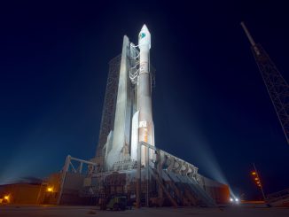
NASA’s $1 billion ICESat 2 mission is set for liftoff at 5:46 a.m. EDT (8:46 a.m. EDT; 1246 GMT) from Vandenberg Air Force Base, a military-run spaceport on California’s Central Coast between Los Angeles and San Francisco.
The satellite will ride into an orbit that flies pole-to-pole aboard the final flight of United Launch Alliance’s Delta 2 rocket, a workhorse launcher with 154 missions in its pedigree that is now on the verge of retirement.
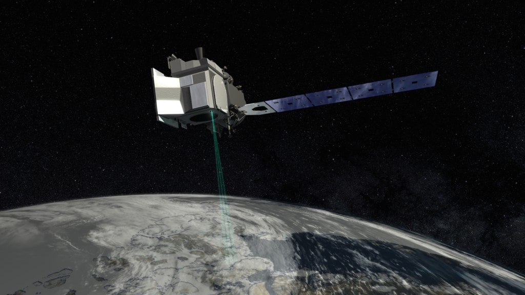
ICESat 2 stands for Ice, Cloud and land Elevation Satellite 2, a follow-on to NASA’s ICESat mission which measured global ice sheets from 2003 until 2009. Equipped with a laser split into six beams, ICESat 2 will fly around 300 miles (500 kilometers) above the planet in an orbit tilted at a 92-degree angle to the equator, giving the mission coverage up to 88 degrees north and south latitude.
Featuring an improved laser instrument designed to provide more precise measurements than its predecessor, ICESat 2 will extend a data series which has shown ice is melting around the edges of Greenland and Antarctica, and is thinning in the oceans.
NASA in recent years has continued surveying ice heights with an airborne campaign called Operation Ice Bridge, showing some trends of melting ice detected by the ICESat satellite continued after that mission ended in 2009. But satellites like ICESat provide more uniform coverage.
“What we learned from ICESat about the ice sheets of Greenland and Antarctica is that they are particularly losing ice around coastal areas, which means, one, that they were losing ice, and also two, it was probably tied to changes occuring in the ocean,” said Tom Wagner, NASA’s cryosphere program scientist.
“With an aircraft, you can’t make the same amount of measurements that you can by satellite,” Wagner said. “What we found with Ice Bridge is that the changes observed by ICESat are not only continuing, but they appear to be accelerating in some cases.”
That’s important because ice conditions are linked to other factors that drive Earth’s climate, such as currents and temperatures in the oceans. And rising sea levels could threaten cities along coastlines.
“In Antarctica and Greenland, we have about two-thirds of the Earth’s fresh water,” said Helen Fricker, a member of ICESat’s science definition team at the Scripps Institution of Oceanography. “If all of that ice melted, we would raise global sea level on average by about 180 feet (54 feet), which is very significant.”
Altimetry data collected by by the U.S.-French TOPEX/Poseidon and Jason series of satellites show the average global sea level rose by 77 millimeters (3 inches) from 1993 through 2017.
“ICESat 2 really is a revolutionary new tool for both land ice and sea ice research,” said Tom Neumann, ICESat 2’s deputy project scientist at NASA’s Goddard Space Flight Center.
NASA has used satellites to look at ice for decades, but tracking ice coverage is easier than measuring the height, and estimating the thickness, of floating sea ice and ice caps covering land masses like Antarctica and Greenland.
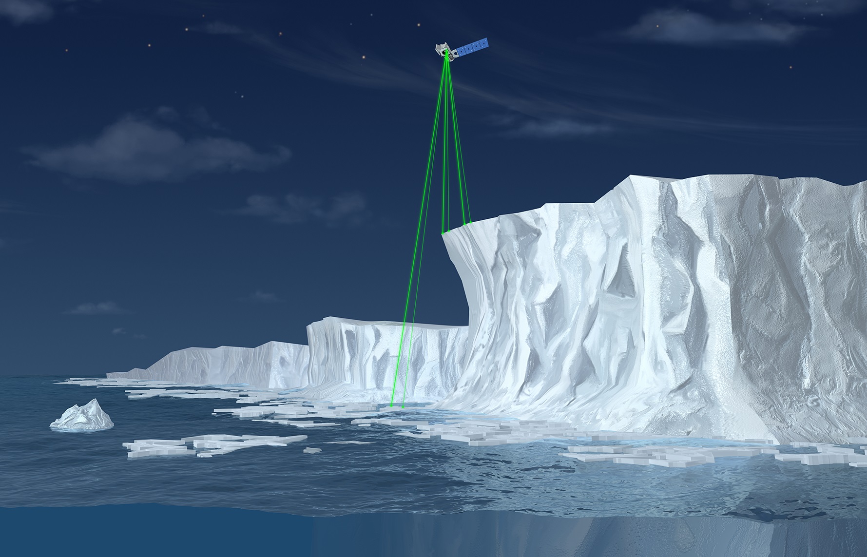
Rather than relying on a single laser beam, as ICESat did, the new mission will fire six laser beams down to Earth and measure the time it takes for the light to bounce off the surface and back to a telescope on-board the spacecraft.
“To measure, or to estimate, the thickness of sea ice, ICESat 2 measures the height of the sea ice floating in the ocean and compares it with the height of the ocean water in cracks in the sea ice,” Neumann said. “By comparing these two elevations, we can calculate the height of the sea ice sticking up out of the ocean water.”
Only about a tenth of total sea ice sticks out above the ocean water line, so scientists can use ICESat 2’s raw measurements to get a handle on the total thickness of the ice floating in the seas. Then scientists will use the ice height information in concert with gravity measurements from space using the GRACE Follow-On mission, which launched in May and helps scientists estimate the mass of the ice.
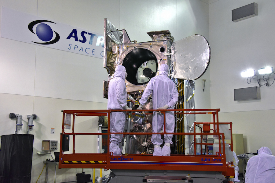
The ICESat 2 satellite was built by Northrop Grumman Innovation Systems, and its single instrument — the Advanced Topographic Laser Altimeter System, or ATLAS — was developed at NASA’s Goddard Space Flight Center.
“ATLAS essentially acts like a stop watch,” said Donya Douglas-Bradshaw, ATLAS instrument manager at Goddard. “The ATLAS laser fires 10,000 pulses per second with a trillion photons in each shot. Each time the laser fires, it starts the stop watch. It takes about 3.3 milliseconds for the beam to exit the instrument, reach the surface and return back to the telescope.”
Only about a dozen or so photons will make it back to ICESat 2’s receiving telescope, with the rest of the light scattering in the atmosphere or back into space.
The laser package “has the ability to time tag a single photon to billionth of a second accuracy,” Douglas-Bradshaw said in a briefing with reporters. “This precision allows the instrument to detect annual changes in ice elevation on the order of half of a centimeter (0.2 inches).”
The photon-counting method is new, and development the ATLAS laser proved to be a challenge, delaying ICESat 2’s launch more than two years, and adding several hundred million dollars to the mission’s cost.
“The original ICESat mission went up, and the scientists looked at the data. They were very excited about that, and they came forward, and they said this mission has to do a lot of better things,” said Doug McLennan, ICESat 2’s project manager at Goddard. “This put the challenge to the engineering team to design a mission that could accmoplish those things. It was a very challenging mission to come up with the ATLAS instrument. It took longer than we thought, but now everything is buttoned up and sitting on top of that rocket and ready to go.”
ICESat 2’s ATLAS instrument actually includes two lasers, with a primary and a redundant emitter, and the pulses go through a diffractive optics element that splits the light into six green beams — each at a wavelength of 532 nanometers — spread across a swath of about 4 miles (6 kilometers) along the satellite’s ground track.
The lasers will travel from the spacecraft down to Earth in pairs, each separated by about 300 feet (90 meters) to provide measurements of the average slope of ice. With 10,000 pulses per second — up from the 40 laser shots per second on the original ICESat mission, the ATLAS instrument will take a height measurement along its track at intervals of every 2.3 feet (70 centimeters) as the satellite travels at approximately 17,000 mph (27,000 kilometers per hour).
As ICESat 2 flies around the planet every hour-and-a-half, the Earth will rotate underneath the satellite’s orbit, allowing the mission to measure global ice heights.
“We have an orbit that is an exact repeat of itself every 91 days,” McLennan said. “That means we see the same piece of ice every three months. Every season, we get to measure what’s happening on that piece of ice, and that allows us to accumulate a dataset year-over-year, from each season to the next.”
The ICESat 2 satellite weighs around 3,340 pounds (1,515 kilograms) at launch, according to McLennan.
McLennan said the spacecraft has enough fuel to operate more than 10 years. ICESat 2’s primary mission is scheduled for three years, but could be extended.
Scientists working in other Earth science disciplines will also get results from ICESat 2.
“ICESat 2 never turns off,” said Lori Magruder from University of Texas at Austin, who led the mission’s science definition team. “It operates all the time, so you get measurements over every single surface.
“We get measurements over the open ocean, and we also get measurements over inland water bodies,” she said. “This is important because we don’t have global measurements that can tell us about our Earth’s reservoirs, so that informs certainly our knowledge of our planet’s water storage.”
The laser ranging instrument on ICESat 2 will also reveal new information about cloud structure as laser photons reflect back to the satellite, and the mission should also provide estimates of the heights of forests.
“From the vantage point of space, we’ll get a global tree height measurement,” Magruder said. “That allows us to create a global biomass estimate. Biomass is important becaause that informs our knowledge of the carbon cycle, and how that contributes to our environment and the climate.”
Email the author.
Follow Stephen Clark on Twitter: @StephenClark1.