The second satellite in a quartet of new NOAA weather observatories is awaiting liftoff Thursday aboard a United Launch Alliance Atlas 5 rocket, heading for a position 22,000 miles from Earth to scan the western United States and Pacific Ocean for typhoons, wildfires and fog.
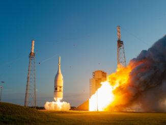
The GOES-S weather satellite, to be renamed GOES-17 once in orbit, is bolted on top of a 197-foot-tall (60-meter) Atlas 5 rocket set for launch from Cape Canaveral at 5:02 p.m. EST (2202 GMT) Thursday.
The launch window extends for two hours, and the official weather outlook calls for an 80 percent probability of favorable conditions.
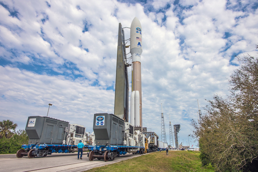
Ground crews at Cape Canaveral transferred the Atlas 5 launcher, with four solid rocket boosters made by Aerojet Rocketdyne, from ULA’s Vertical Integration Facility to the Complex 41 launch pad Wednesday morning.
Once at the pad, the launch team planned to load the Atlas 5’s first stage with RP-1 kerosene fuel. The launcher’s RD-180 main engine will consume the kerosene in combination with super-cold liquid oxygen, which will be pumped aboard the Atlas 5 during Thursday’s countdown, scheduled to formally commence at 10:12 a.m. EST (1512 GMT).
Engineers will power up the Atlas 5 rocket, then load liquid oxygen into the launcher’s main stage and Centaur upper stage, plus cryogenic liquid hydrogen into the second stage to fuel the Centaur’s Aerojet Rocketdyne RL10 main engine.
A final pre-launch poll is scheduled during a planned hold in the countdown at T-minus 4 minutes, and an automated launch sequencer will control the final minutes before liftoff.
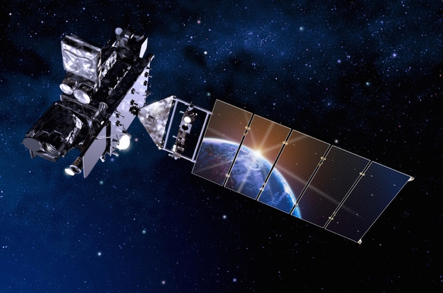
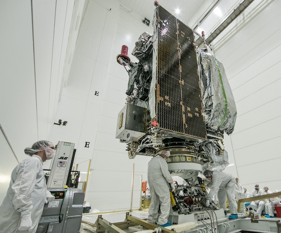
Built by Lockheed Martin, the GOES-S spacecraft is poised to join a sister satellite, named GOES-16, which flew into orbit in November 2016 on a previous Atlas 5 rocket. Like GOES-16, GOES-S carries six instrument packages to survey weather conditions on Earth and in space.
The GOES satellites, launched in series since 1975, are the “backbone of weather and climate forecasts,” said Stephen Volz, director of NOAA’s satellite and information services.
Imagery from the GOES satellites are featured in weather broadcasts and used as a primary forecasting tool by meteorologists across the Western Hemisphere, helping track tropical cyclones and tornado-spawning severe storms, plus monitoring for snow and ice cover, wildfires and fog that threaten transportation and property.
The newest family of GOES satellites, beginning with GOES-16 launched in 2016, offer a “quantum leap” in capability over NOAA’s earlier generations of geostationary weather observatories, Volz said in a briefing with reporters Tuesday.
The Advanced Baseline Imager on the latest four GOES satellites can return scans of an entire hemisphere once every 15 minutes, half the time needed by one of NOAA’s earlier geostationary spacecraft. The imager can scan the continental United States once every 5 minutes.
The new ABI-equipped satellites can return pictures of hotspots like hurricanes at a cadence of once every 30 seconds, an improvement from the five-minute rapid scans available today.
The imager, built by Harris Corp. in Fort Wayne, Indiana, can simultaneously scan the broader hemisphere in its field-of-view and capture close-up views of individual storm systems, giving forecasters refreshed views of hurricanes and tornado outbreaks.
The ABI can see in 16 visible and infrared channels, yielding deeper insights into moisture levels and cloud types unavailable with previous weather satellite images. Earlier GOES satellites had imagers sensitive to five different parts of the light spectrum.
The upgrade allows meteorologists to distinguish between snow, fog, clouds, volcanic ash, and other particles suspended in the atmosphere.
Data from the GOES-16 satellite, which now provides real-time imagery over the eastern United States, the Atlantic Ocean, the Caribbean and Latin America, has astounded forecasters in its first year of observations.
“GOES-16, even beyond its spectacular imagery, is already proving to be a game changer with much more refined, higher quality data for faster and more accurate weather forecasts and warnings,” said Ajay Mehta, acting deputy assistant administrator for systems at NOAA’s satellite and information service. “This means more lives are saved and better environment intelligence for state and local officials, who, for example, may need to make decisions about when to call for evacuations ahead of life-threatening wildfires.”
Before officials declared it operational, GOES-16 recorded detailed views of powerful hurricanes last year churning in the Atlantic Ocean, the Gulf of Mexico and the Caribbean Sea.
GOES-16 tracked movements of Hurricane Harvey as it approached the Texas coast and dropped inundating rainfall over Houston, then watched as Hurricane Irma struck Florida and Hurricane Maria made a devastating landfall in Puerto Rico.
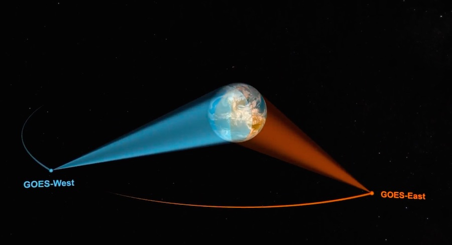
NOAA made GOES-16 operational in the so-called “GOES-East” position at the equator over 75 degrees west longitude in December. GOES-S, soon to be named GOES-17, will take a position in the “GOES-West” location at 137 degrees west longitude.
“When it launches March 1 and becomes operational later this year, GOES-S will see the west in true high-definition, and along with the remaining satellites in our GOES-R series, will extend the life of NOAA’s geostationary satellite constellation through 2036,” said Tim Walsh, acting director of NOAA’s GOES-R program.
“These satellites are giving us the ability to look at storms as often as every 30 seconds, allowing forecasters to see storms as they’re developing instead of as they’ve already happened,” Walsh said.
NOAA’s new space-based weather observing capabilities should result more accurate, and timely, forecasts for the West Coast, Alaska, Hawaii and much of Mexico and Central America.
“The West Coast states, as we’ve seen recently over the last few months, can be especially impacted by wildfires, dense fog and very strong storms that can produce deadly floods and mudslides,” Walsh said.
The sharp-eyed imager aboard GOES-S will also help spot smoke plumes from wildfires and map volcanic discharges that threaten aviation and air quality.
“Airports have to shut down because of heavy fog at times,” Volz said. “With the lower resolution of the existing satellites, there might be a pixel which is 10 kilometers in size, which covers an airport and all around it, whereas with the higher-resolution of GOES-R, where you have 1 or 2 kilometers or better, you can pinpoint where there’s fog and where there isn’t.”
An experiment during heavy fog at San Francisco International Airport last year using GOES-16 — before it was repositioned over the Atlantic Ocean — demonstrated the satellite’s upgraded imager could see fog burn off sooner than possible with earlier weather observatories, Volz said.
That allowed the airport to reopen earlier than expected, helping travelers safely get to their destinations sooner and saving airlines around $100,000 in unnecessary costs, he said.
GOES-S will also get a better look at ice flows and other seasonal weather patterns in Alaska, officials said, allowing forecasters there to use more GOES satellite data in their daily outlooks. In the past, forecasters in Alaska could not count on the highest-quality imagery from GOES satellites because of their oblique viewing angle from equatorial orbit.
Like its predecessor already in space, GOES-S carries a detector to locate in-cloud, cloud-to-cloud and cloud-to-ground lightning strikes day or night, giving weather forecasters an inventory of the location, frequency and intensity of lightning activity that could help warn the public of severe storms.
Other instruments on GOES-S will look at the sun and chart solar radiation output and solar flares, which affect conditions in Earth’s upper atmosphere and generate geomagnetic storms, leading to possible disruptions in communications, navigation and electrical infrastructure.
An ultraviolet solar camera fitted to a telescope on GOES-S will take full disk images of the sun.
A magnetometer and space environment sensor will measure particles and electric fields in space, providing data on charging conditions that could damage other satellites.
GOES-S also hosts a transponder to receive faint distress beacons anywhere on Earth that is visible to the spacecraft. The signals will be relayed to search-and-rescue forces on the ground.
With two modernized satellites in geostationary orbit, NOAA officials said forecasters from New Zealand to West Africa, and from Canada to Patagonia, will have a critical new tool at their fingertips. A pair of Japanese Himawari satellite launched in 2014 and 2016 carry the same type of advanced imager as the new GOES craft, extending the improved coverage into the Asia-Pacific region.
Two more satellites in the GOES-R program — GOES-T and GOES-U — are in assembly at Lockheed Martin’s factory in Denver for launches in 2020 and 2024.
NOAA has budgeted $11 billion for the program, a figure that includes the four spacecraft, weather instruments, launch services and ground systems.
Tim Gasparrini, vice president for the GOES-R program at Lockheed Martin, said in an interview Wednesday that the GOES-S spacecraft is powered up and ready for Thursday’s launch.
“It’s not often that you get to build something that touches hundreds of millions of people,” Gasparrini said. “In the same facility, we build planetary spacecraft and those go out and do phenomenal science, but this one actually touches the lives and protects the property of hundreds of millions of people.”
Weighing in at 11,488 pounds (5,211 kilograms), GOES-S will ride ULA’s Atlas 5 rocket to orbit on a three-and-a-half hour flight Thursday.
After dropping four 67-foot-tall (20-meter), 50-ton (46-metric ton) strap-on boosters and its Swiss-made payload shroud, the Atlas 5’s core stage will fire its Russian-made RD-180 engine until T+plus 4 minutes, 21 seconds.
Six seconds later, the Atlas booster will jettison from the Centaur upper stage, and an RL10 engine will ignite for the first three firings to place GOES-S into its targeted orbit.
The first RL10 engine burn will end shortly after T+plus 12 minutes, followed 10 minutes later by a second maneuver lasting five-and-a-half minutes. Three hours later, third and final Centaur burn, expected to last around 95 seconds, will send GOES-S into an elliptical transfer orbit ranging in altitude between 5,104 miles (8,215 kilometers) and 21,926 miles (35,286 kilometers).
The third Centaur firing will move GOES-S’s orbit closer its final equatorial operating post, and the upper stage will release the spacecraft at T+plus 3 hours, 32 minutes, on a track inclined 9.5 degrees to the equator.
GOES-S will use its own propellant supply for the final journey toward its perch in a circular geostationary orbit nearly 22,300 miles (35,800 kilometers) over the equator, where its speed will match that of Earth’s rotation, giving its weather instruments a constant view of the same part of the planet.
The Atlas 5’s flight sequence will mostly mimic the launch of the GOES-16 — then known as GOES-R — satellite in November 2016, but the final Centaur firing will inject the spacecraft into an orbit one degree closer in latitude to the equator.
That will translate into nearly a year’s worth of extra fuel life for GOES-S, which is designed for a 15-year mission but has enough propellant to last 20 years in space.
Email the author.
Follow Stephen Clark on Twitter: @StephenClark1.