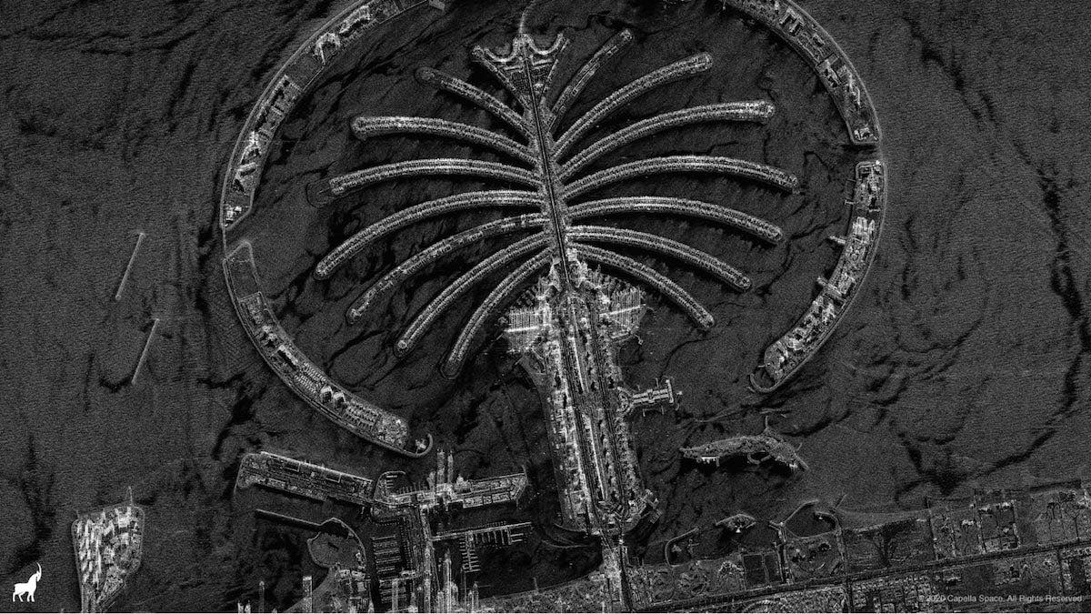
Capella Space has released the first images from its Sequoia radar remote sensing spacecraft, a commercial imaging platform that launched in August as the first of a constellation that could number 36 radar observation satellites.
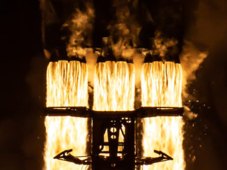
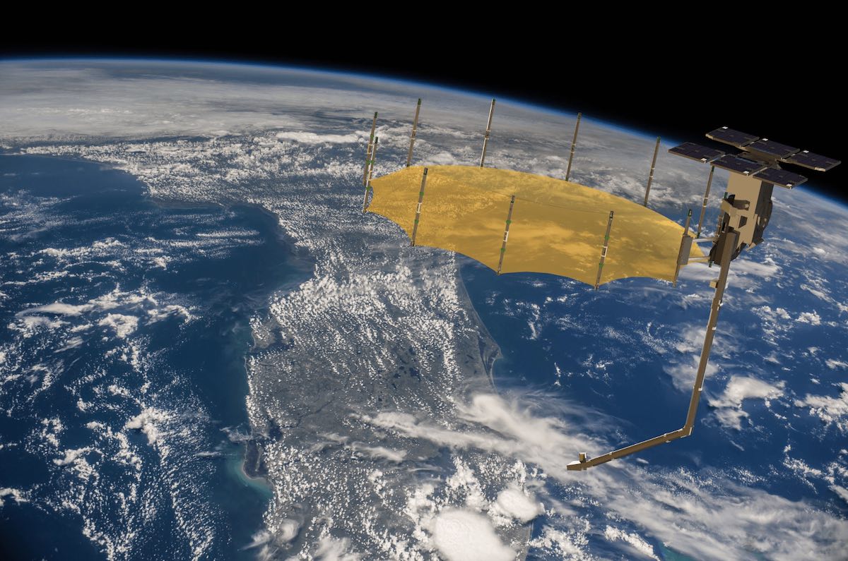
The roughly 220-pound (100-kilogram) Sequoia satellite lifted off Aug. 30 from New Zealand on a Rocket Lab Electron launcher. Since then, Capella has deployed the satellite’s radar reflector antenna to a diameter of about 11.5 feet (3.5 meters) and begun collecting imagery.
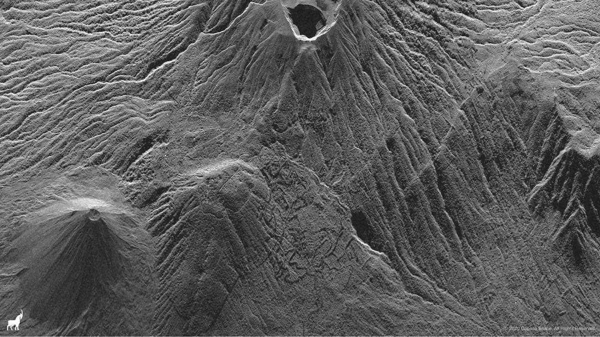
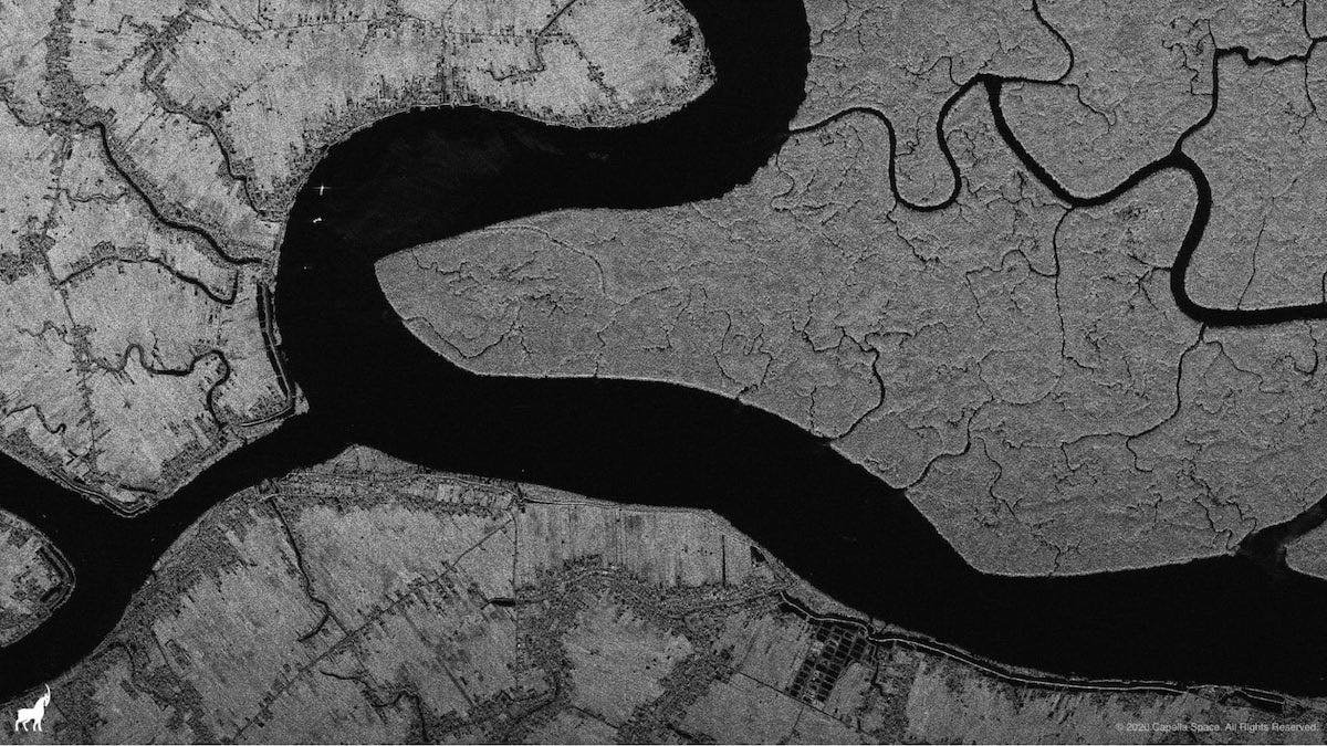
Capella, based in San Francisco, described the views from Sequoia as the “America’s first commercial SAR (Synthetic Aperture Radar)” images from space. At a resolution of about 2 meters, or 6.6 feet, the radar images are sharp enough to show boats, wakes, and waves on water surfaces, along with human-made patterns in agricultural zones.
Payam Banazadeh, founder and CEO of Capella, wrote in an Oct. 6 blog post on the company’s website that the images from represent a “historic moment” for the U.S. Earth observation satellite industry.
“When I started Capella Space in 2016, there were a number of European providers operating and building commercial SAR, but the United States had no horse in the commercial SAR race,” Banazadeh wrote. “Capella decided to change that dynamic, and challenge the international competition by bringing a fully American designed, built, and operated capability to market. Today we accomplished that goal and we can proudly say we are the first American SAR operator.”
Radar imaging satellites have historically been large and power-hungry, requiring investments of hundreds of millions of dollars per spacecraft, a cost that could only be burdened by governments or large multinational companies. But miniaturized technology is starting to allow smaller companies, including startups like Capella Space, to develop radar satellites.
A Finnish company named ICEYE is also building out a fleet of small commercial radar observation platforms in orbit. ICEYE has launched seven radar satellites to date, more than Capella. But Capella is a U.S. company, which could give it an advantage selling to the U.S. military.
Capella already has contracts with the National Reconnaissance Office, the U.S. Air Force, and the U.S. Navy to study military uses of commercial radar satellite imagery. The National Geospatial-Intelligence Agency signed a Cooperative Research and Development Agreement, or CRADA, earlier this year to allow researchers from the U.S. government’s intelligence community to assist Capella.
Capella plans a constellation of small satellites to enable rapid revisit, allowing the company’s orbiting radar observers to collect imagery of the same locations multiple times per day. That will allow government and commercial customers to detect changes in the environment.
Other remote sensing companies have similar business plans.
Planet, another San Francisco-based company, operates a fleet of around 150 small optical Earth observation satellites. BlackSky is also deploying a constellation of optical remote sensing spacecraft.
But Capella’s satellites use synthetic aperture radar technology, allowing imagery collection night and day and in all weather conditions. Optical satellites are limited to observations in daylight and in cloud-free skies.
In an interview before the launch of Sequoia, Banazadeh said Capella is initially deploying a fleet of seven radar remote sensing satellites. That could be scaled up given sufficient demand, he said.
Capella has a license from NOAA, which regulates space-based remote sensing by U.S. companies, for a constellation of 36 small radar surveillance satellites. The company says it also has permission from U.S. regulators to sell high-resolution radar images globally.
The images released by Capella on Oct. 6 were taken the Sequoia satellite’s “Strip” imaging mode, with 2-meter resolution.
“Over the coming weeks and months, we will continue sharing images that showcase some of the higher resolution imagery including our 50-centimeter (20-inch) resolution Spot, more advanced capabilities, and the unique advantages of our systems,” Banazadeh wrote Oct. 6. “These advantages will include exceptionally large imaging capacity, the highest resolution available commercially, near real-time collection and delivery latency, and incredible ease of use of our services and customer service.”
The next two Capella imaging satellites are scheduled to launch before the end of the year.
Capella launched a test satellite named Denali in 2018, but the company did not publicly release any radar images from the spacecraft.
After surveying prospective customers, Capella began redesigning its next series of larger satellites to gather sharper imagery, and collect more data on shorter notice, two leading demands from consumers of satellite remote sensing data. The result was a new class of satellites Capella calls the Whitney fleet. Sequoia was the first of the upgraded radar satellites to launch.
Email the author.
Follow Stephen Clark on Twitter: @StephenClark1.