China launched the capstone satellite for the Beidou navigation constellation Tuesday, adding the final piece to a global network to rival the U.S. military’s GPS fleet providing positioning, timing, and search and rescue services.
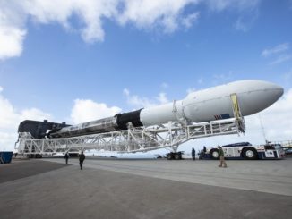
The final Beidou satellite took off at 0143 GMT Tuesday (9:43 p.m. EDT Monday) aboard a Long March 3B rocket from the Xichang launch center.
Liftoff occurred at 9:43 a.m. Beijing time, and Chinese state television broadcast live video of the rocket launch. Live video streams of Chinese space launches are rare, and the decision by authorities to broadcast the mission signals the importance of the Beidou network to the Chinese government.
Some high-profile Chinese space missions, such as launches of astronauts and flights of the country’s heavy-lift Long March 5 rocket, have been similarly publicized by Chinese state television.
The mission to carry the final Beidou satellite aloft was postponed from June 16 after the Long March 3B rocket “was found having technical problems during pre-launch tests,” according to China’s state-run Xinhua news agency.
The Long March 3B rocket fired into an overcast sky over Xichang, a launch base situated amid mountains thick with vegetation in southwestern China’s Sichuan province.
Four liquid-fueled boosters, burning a toxic mix of hydrazine and nitrogen tetroxide, fired in concert with the Long March 3B’s four core stage engines to power the rocket into the upper atmosphere with 1.3 million pounds of thrust.
A second stage took over control of the flight around two-and-a-half minutes into the mission, followed by stage separation and ignition of two hydrogen-fueled engines on the Long March 3B’s cryogenic third stage.
A video feed from the rocket’s third stage showed the Beidou navigation satellite deploying in a preliminary orbit around 25 minutes after liftoff. Moments later, the spacecraft was seen extending its solar arrays to begin generating electrical power.
The final Beidou satellite to round out the Chinese navigation network was built by the China Academy of Space Technology. Based on the DFH-3B satellite platform, the spacecraft weighs more than 10,000 pounds, or about 4,600 kilograms, filled with propellants for maneuvers in orbit.
China designed the Beidou Navigation Satellite System, or BDS, as an independent version of the GPS network, providing Chinese military and civilian users with a home-grown system in case the U.S. military interrupts GPS signals during a conflict. Like the GPS network, Russia’s Glonass fleet and Europe’s Galileo navigation constellation, the Beidou system is designed for global service.
China’s final Beidou navigation satellite has deployed from its Long March 3B rocket into the planned orbit.
Moments after separation, the spacecraft unfurled its power-generating solar arrays. (📷: @CGTNOfficial). https://t.co/O5Bvr0NOSf pic.twitter.com/MeUzr9TYxe
— Spaceflight Now (@SpaceflightNow) June 23, 2020
The Long March 3B rocket launch puts China on the verge of completing the deployment of the Beidou program’s third-generation, or BDS-3, satellite network. It was be the 35th BDS-3 satellite launched since 2015 — including test and validation satellites — and the 59th Beidou spacecraft launched since 2000.
China has reportedly spent approximately $10 billion on the Beidou program, which the Chinese government approved for development in 1994.
The Beidou network, named for the Chinese word for the Big Dipper constellation, includes satellites positioned in three different types of orbits. The Beidou system needs at least 30 satellites operating at any one time for uninterrupted global navigation service.
In December, China launched the last of 24 operational satellites into a medium-altitude orbit more than 13,000 miles (21,000 kilometers) above Earth, similar to the orbits used by GPS, Glonass and Galileo satellites.
But unlike the other global navigation systems, the fully-operational Beidou network includes six spacecraft in geosynchronous orbits more than 22,000 miles (nearly 36,000 kilometers) above Earth, with three permanently over the equator and three others in inclined orbits that swing north and south of the equator during each 24-hour orbit.
China launched three satellites into inclined geosynchronous orbits last year, and the final Beidou spacecraft launched Tuesday is the third of three to be permanently stationed over the equator.
The satellite delivered to orbit Tuesday will use its on-board propulsion to circularize its orbit more than 22,000 miles over the equator in the coming weeks before ground controllers put the spacecraft through testing. It is expected to enter service in a few months.
The first four Beidou satellites broadcast positioning and timing signals over China. The second phase of the Beidou system, known as BDS-2, was completed in 2012 to provide navigation services over the broader Asia-Pacific region.
As of this week, China’s Beidou network had 44 operational spacecraft, including BDS-2 and BDS-3 satellites.
In addition to military uses, China says Beidou services are used in transportation, agriculture, fishing, and disaster relief. More than 70 percent of smartphones in China are equipped to receive Beidou signals, and more than half of countries worldwide are using Beidou services, according to the state-run Xinhua news agency.
China is also using the Beidou system as a diplomatic and economic tool, making it part of the country’s Belt and Road foreign policy initiative making strategic investments in developing countries.
Chinese officials say the Beidou system has a position accuracy of better than 16 feet, or 5 meters.
“After the global system is completed this year, the BDS can provide satisfactory services to every corner of the world,” said Yang Changfeng, chief designer of the Beidou system, according to Xinhua.
By 2035, with the BDS as the core, China plans “a more ubiquitous, integrated and intelligent navigation and timing system with comprehensive national positioning,” Xinhua said.
Email the author.
Follow Stephen Clark on Twitter: @StephenClark1.