A new weather satellite destined for a perch over the Pacific Ocean and the Western United States was mounted on top of a United Launch Alliance Atlas 5 rocket Thursday at Cape Canaveral, moving a step closer to launch scheduled for March 1.
The GOES-T spacecraft is the latest in NOAA’s fleet of orbiting weather observatories collecting imagery and data to help forecasters predict the development and evolution of severe thunderstorms, hurricanes, and wildfires.
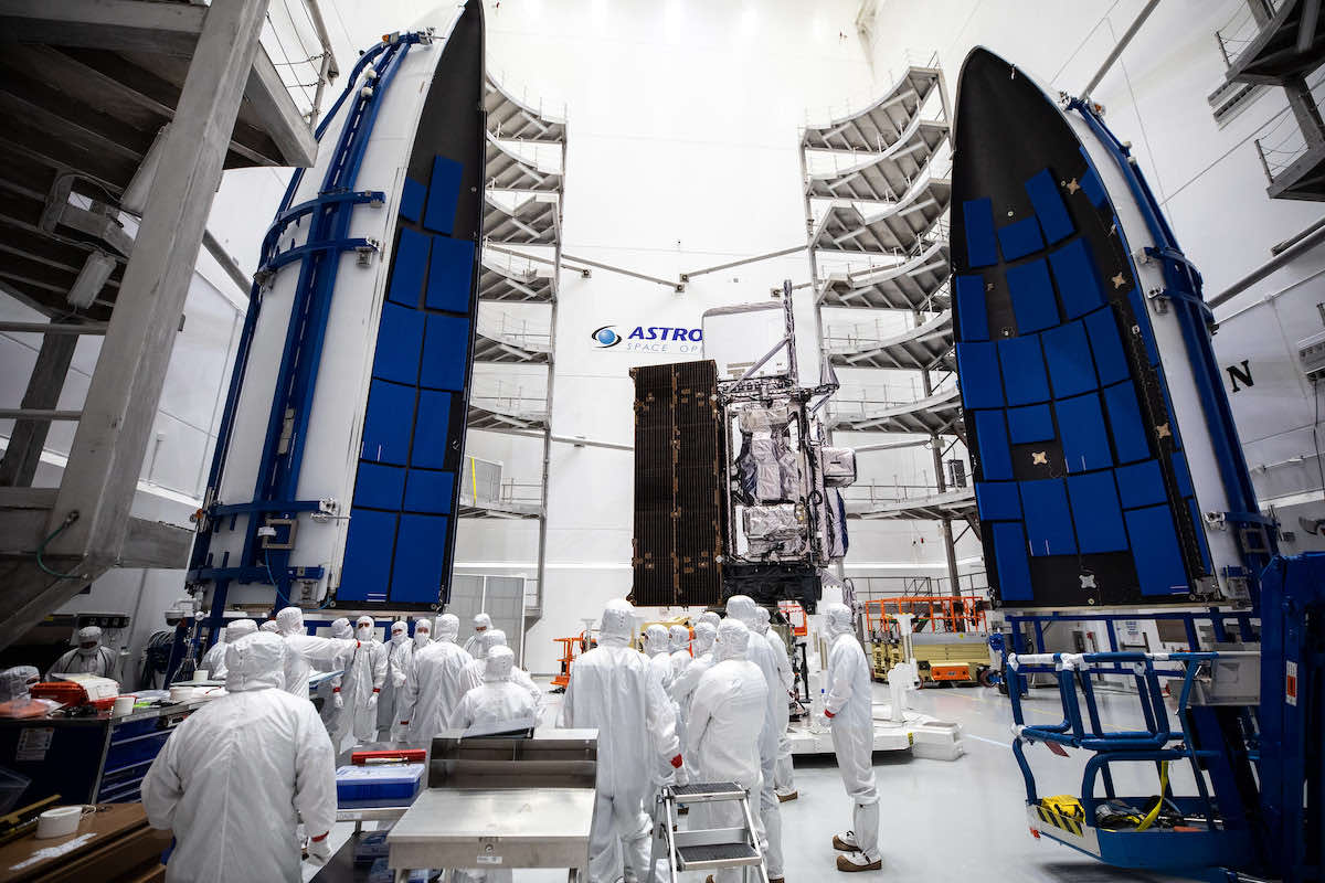
The satellite was encapsulated inside the Atlas 5 rocket’s payload shroud at the Astrotech payload processing facility in Titusville on Feb. 7, then transferred through Kennedy Space Center on Thursday to ULA’s Vertical Integration Facility at Cape Canaveral Space Force Station.
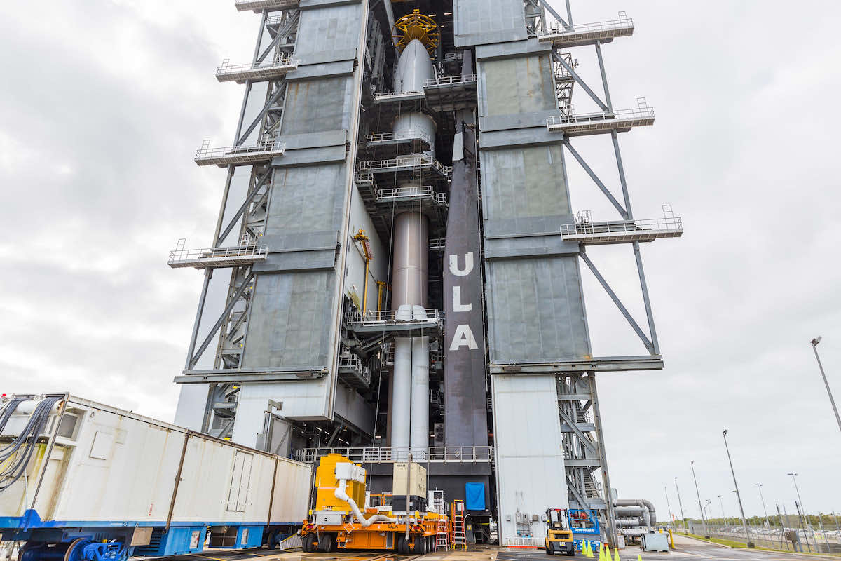
A crane raised the composite payload compartment, containing the GOES-T satellite, on top of the Atlas 5 rocket on its launch platform. The addition of the white nose cone capped assembly of the Atlas 5, standing 196 feet (59.7 meters) tall.
Stacking of the Atlas 5 rocket began last month, when ground crews lifted launcher’s bronze first stage on its mobile platform Jan. 31, 10 days after the previous Atlas 5 launch. ULA next installed four Northrop Grumman-built solid rocket boosters around the Atlas 5’s core stage, then raised the Centaur upper stage atop the first stage Feb. 7.
The rocket will fly in the Atlas 5’s “541” configuration with a 5.4-meter (17.7-foot) diameter payload fairing, four strap-on boosters, and a single RL10 upper stage engine.
The two-hour launch window March 1 opens at 4:38 p.m. EST (2138 GMT). ULA will transfer the Atlas 5 rocket with GOES-T to the launch pad Feb. 28.
The launch with NOAA’s GOES-T weather satellite will mark the 92nd flight of an Atlas 5 rocket since August 2002, and the eighth flight to use the “541” version, following two previous GOES satellites, NASA’s Curiosity and Perseverance Mars rovers, and three spy satellite launches for the U.S. government.
The GOES-T satellite, with a launch weight of more than 11,000 pounds (5 metric tons) fully fueled, was built by Lockheed Martin and arrived in Florida from its Colorado factory in November. Technicians at Astrotech tested the satellite to make sure it survived the cross-country journey, then loaded liquid propellants into the spacecraft for its main engine.
After three burns with the Centaur’s RL10 engine, the Atlas 5 will deploy the GOES-T satellite in an elongated orbit ranging between 5,515 miles (8,876 kilometers) and 21,925 miles (35,286 kilometers). The orbit will be tilted at an angle of 9.4 degrees to the equator.
GOES-T’s own propulsion system will circularize the satellite’s orbit more than 22,000 miles (nearly 36,000 kilometers) over the equator. At that altitude, in geosynchronous orbit, the satellite’s movement will match the Earth’s rotation, giving the spacecraft a constant view of one hemisphere.
NOAA’s Geostationary Operational Environmental Satellites take regularly-updated images of clouds and storm systems, providing real-time views of tropical cyclones and severe weather. The first GOES satellite launched in 1975, and NOAA maintains two operational GOES spacecraft — one covering the Pacific and Western United States, and another over the East Coast, the Caribbean, and the Atlantic Ocean.
NOAA’s weather satellites in polar orbit gather data for medium and long-term forecasts.
GOES-T will be renamed GOES-18 after launch, when it will begin a nearly year-long series of checkouts and tests before NOAA declares the satellite operational. The first weather images from GOES-18 could come down in May, and data from the new satellite could be provided to National Weather Service forecasters on a provisional basis as soon as July, said Pam Sullivan, director of NOAA’s GOES-R program.
The GOES-R series is NOAA’s newest generation of geostationary weather satellites, and GOES-T is the third of four satellites in the group, following launches of GOES-R and GOES-S — now named GOES-16 and GOES-17 — in 2016 and 2018.
By early 2023, GOES-18 will move into the GOES West position to take over from GOES-17, which NOAA will transition to a backup role in the fleet. GOES-16 will remain the active GOES East satellite.
“NOAA’s geostationary satellites provide the only continuous coverage of weather and hazardous environmental conditions in the Western Hemisphere, protecting the lives and properties of the 1 billion people who live and work there,” Sullivan said. “The observations from these satellites are even more critical now when the U.S. is experiencing a record number of billion dollar disasters.”
Like the two previous GOES satellites launched in 2016 and 2018, the GOES-T satellite carries six instruments to monitor terrestrial and space weather.
The Advanced Baseline Imager, produced by L3Harris, is the primary instrument. The ABI can see in 16 different visible and infrared wavelengths to determine cloud type, distinguish between clouds, fog and volcanic ash, and track moisture movements inside clouds. Previous GOES satellite cameras could only see in five channels.
Not only can the Advanced Baseline Imager resolve more detail, but the camera can capture images at a faster cadence than previous GOES satellites — hemispheric views every 15 minutes, and imagery of the continental United States every five minutes.
The GOES-R series of satellites can return pictures of hotspots like hurricanes at a cadence of once every 30 seconds, an improvement from the five-minute rapid scans available before 2016.
GOES-T also hosts lightning detectors and sensors to monitor solar activity and space weather.
The new spacecraft set for launch March 1 has several changes from the first two GOES-R type satellites.
The ABI instrument on GOES-17 has degraded function in some of its infrared channels, a problem engineers believe was most likely caused by foreign object debris blocking the flow of coolant in the instrument’s thermal control system. The cooling system malfunction means the instrument’s detectors are unable to stay at the proper temperatures at certain times, leading to intermittent loss off some infrared imagery.
On GOES-T and the GOES-U satellite set for launch in 2024, engineers modified the design of the Advanced Baseline Imager’s radiator to eliminate filters where foreign object debris can become trapped.
The GOES-T satellite also has an upgraded magnetometer instrument provided by NASA’s Goddard Space Flight Center.
NASA partners with NOAA on development of weather satellites, overseeing contracts to develop the spacecraft, instruments, and procure launch vehicles. NOAA operates and owns the satellites.
The GOES-R program is costing $11.7 billion, including expenditures for four satellites, instruments, launch services, and operations, according to Sullivan.
Email the author.
Follow Stephen Clark on Twitter: @StephenClark1.