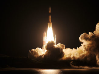
A Japanese launch crew filled an H-2A rocket with cryogenic liquid hydrogen and liquid oxygen propellants in time for a planned liftoff Saturday with a geostationary navigation satellite, but a problem inside the launcher’s propulsion system prompted officials to postpone the mission.
Officials announced a hold less than two hours before the 174-foot-tall (53-meter) H-2A rocket was set to blast off at 0440 GMT (12:40 a.m. EDT; 1:40 p.m. Japan Standard Time). The H-2A launch team called off the launch attempt several hours later, after the opening of an unusually-long launch window stretching nearly nine hours long.
The Japan Aerospace Exploration Agency said the launch was scrubbed to ensure the readiness of the H-2A rocket’s propulsion systems. Officials said in a press conference Saturday that engineers were studying possible leak in the rocket’s helium pressurization system.
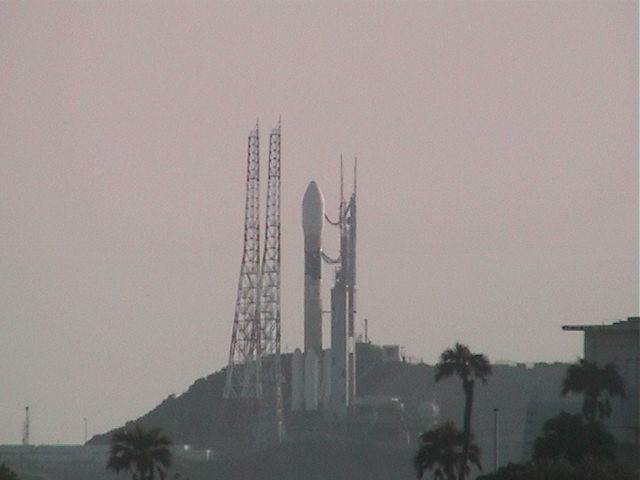
The H-2A rocket was still on its launch pad as the sun rose Sunday at the Tanegashima Space Center, a spaceport overlooking the Pacific Ocean on the coast of southern Japan.
Fitted with four solid-fueled boosters and a 16.7-foot (5.1-meter) diameter payload shroud, the souped-up H-2A rocket is set to make its 35th flight, and its fourth launch this year.
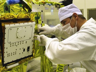
The Michibiki 3 navigation craft mounted atop the H-2A rocket will join two similar satellites already in orbit designed to aid security forces and civilians users in Japan find their position. With the addition of a fourth navigation craft later this year, the Quasi-Zenith Satellite System will supplement positioning services over Japan provided by the U.S. military’s Global Positioning System satellites.
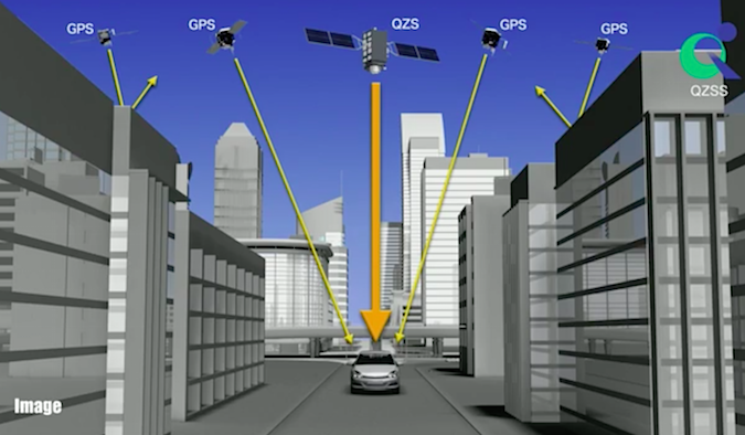
The GPS satellites circle Earth in orbits 12,550 miles (20,200 kilometers) above Earth. Although there are at least 30 operational GPS spacecraft, only a small fraction of the fleet is visible from a single point on Earth at one time.
It takes four GPS satellites to calculate a precise position on Earth, but a Michibiki satellite broadcasting the same four L-band signals will give a receiver an estimate if there are not enough GPS satellites visible, or it can help produce a more accurate position calculation even with full GPS service.
The navigation aids are particularly useful in regions like central Tokyo and other urban centers, where high-rise buildings can block GPS signals from satellites near the horizon. Travelers in rugged terrain can also benefit from the additional coverage, where mountains and steep ridges can interrupt satellite signals.
The two Michibiki satellites launched to date fly in inclined orbits, tracing figure-eight patterns as they oscillate north and south of the equator, while their longitudinal, or east-west, position remains over the Asia-Pacific at an average altitude of around 22,300 miles (nearly 35,800 kilometers) above Earth.
Michibiki 3 will head into an orbit at the same altitude, but will eventually settle into a parking slot over the equator, where it will remain in a fixed geostationary position in the sky.
The fourth in the current series of Japanese navigation satellites will go up later this year on another H-2A rocket, taking up a post in an inclined high-altitude orbit like the first two.
Email the author.
Follow Stephen Clark on Twitter: @StephenClark1.