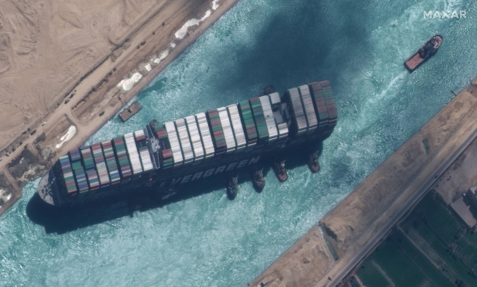
Satellite remote sensing companies showcased their capabilities in recent days with regularly-updated overhead views of a 1,300-foot-long (400-meter) container ship blocking the Suez Canal in Egypt before salvage crews freed the vessel Monday.
The satellite images showed tow boats, a dredging ship, and other vessels around the Ever Given container ship in recent days. Teams working around-the-clock finally dislodged the 220-ton ship Monday, six days after it ran aground in the Suez Canal during a journey from China to the Netherlands.
The wedged ship blocked other ships from crossing through the Suez Canal, which connects the Mediterranean Sea with the Red Sea, a heavily-trafficked route for goods between Asia, Europe, and points beyond.
Crews successfully refloated the Japanese-owned container ship Monday with help from a high spring tide, although it was not immediately clear how soon some 400 vessels delayed by the incident might be able to enter the canal.
The giant container ship’s six-day blockage fo the Suez Canal temporarily interrupted global trade. It also provided an opportunity for commercial satellite companies to share views from space of the unfolding crisis hundreds of miles below.
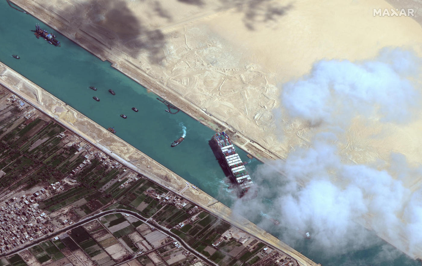
Maxar, which owns Earth-imaging satellites acquired from DigitalGlobe, released daily images of the container ship. One of Maxar’s newest images was captured by the GeoEye 1 satellite, one of the oldest spacecraft in the company’s fleet.
The GeoEye 1 image released Monday was taken at 11:52 a.m. local time in Egypt, showing the Ever Given had started moving after dredging ships — aided by an unusually high tide — successfully freed the ship.
Built by General Dynamics, now part of Northrop Grumman, GeoEye 1 launched in 2008 aboard a United Launch Alliance Delta 2 rocket from Vandenberg Air Force Base, California. The spacecraft orbits Earth at an altitude of about 423 miles (680 kilometers), and its optical imager has a maximum resolution of about 16 inches (41 centimeters).
Maxar’s WorldView 2 satellite, which launched from Vandenberg in 2009 on another Delta 2 mission, caught a glimpse of the Ever Given container ship a few minutes before GeoEye 1.
Manufactured by Ball Aerospace, WorldView 2 flies at an altitude of about 475 miles (765 kilometers), slightly higher than GeoEye 1. It’s optical instrument has a resolution as good as 18 inches (46 centimeters).
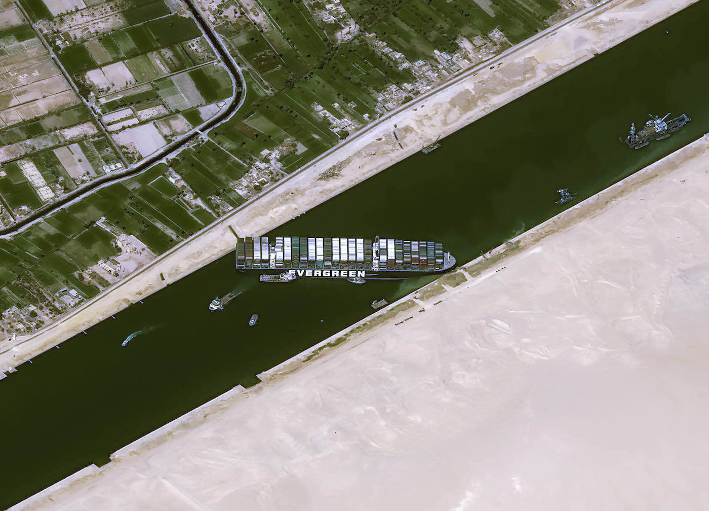
Airbus also released imagery from one of the Pléiades high-resolution optical imaging satellites. The two Pléiades satellites orbit around 435 miles (700 kilometers) above Earth, and were built in France by Airbus Defense and Space. The Pléiades satellites launched from French Guiana on two Soyuz rockets in 2011 and 2012.
The Pléiades satellites collect imagery for the French military and civil government users. Airbus is responsible for selling Pléiades satellite imagery to commercial customers, with a resolution of about 20 inches (50 centimeters).
The San Francisco-based company Planet also released several views of the stuck container ship in the Suez Canal, including a video recorded by one fo the company’s SkySat satellites as it flew overhead.
A Planet SkySat captured video of the ongoing efforts to dislodge the Ever Given from the Suez Canal after it ran aground late Tuesday, blocking all traffic.
Video captured by SkySat on March 27, 2021. pic.twitter.com/vw9xPT1C6j
— Planet (@planetlabs) March 28, 2021
The SkySats, which were also built by Maxar, are about the side of a mini-refrigerator, with each weighing around 242 pounds (110 kilograms) at launch. The Airbus and Maxar-owned Earth observation satellites are all more than a ton in mass.
The Dove and SuperDove satellites — each as small as a shoebox or toaster oven — collect less-detailed optical images, but their numbers allow Planet to take a picture of the same location on Earth every day, instead of waiting for a single spacecraft to make another pass over the same target.
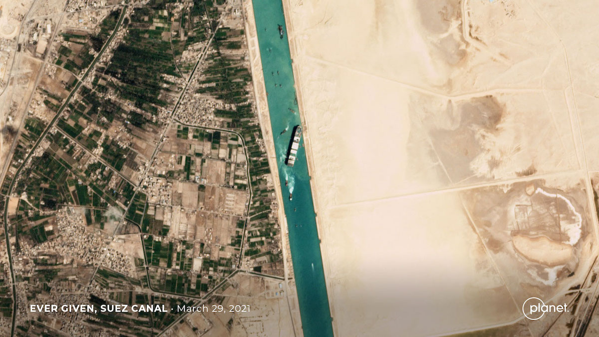
Planet operates more than 100 small Earth observation satellites, including a fleet of 21 SkySat satellites and numerous smaller Dove and SuperDove-class spacecraft. The SkySats fly around 250 miles (400 kilometers) above Earth, where their optical telescopes can produce images with a resolution of about 20 inches, with detail similar to pictures acquired by the much larger Pléiades, WorldView, and GeoEye satellites in higher orbits.
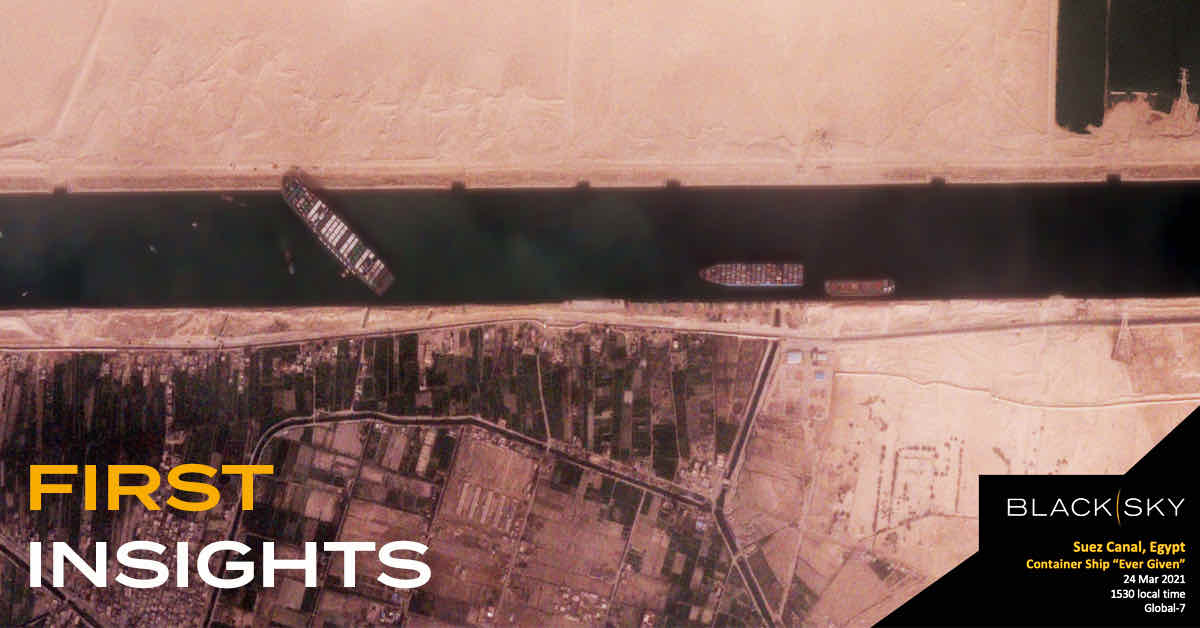
BlackSky, a Seattle-based company deploying its own fleet of optical survey satellites, released an image of the Ever Given container ship captured March 24. The company said the picture was taken by the BlackSky Global-7 spacecraft, which launched last August from the Kennedy Space Center in Florida on a SpaceX Falcon 9 rocket along with a batch of Starlink internet satellites.
BlackSky has launched seven small Earth observation satellites since 2018, each about half the mass of one of Planet’s SkySats. The company’s satellites fly about 280 miles (450 kilometers) above Earth, producing imagery with a resolution of about 3 feet (1 meter).
Radar satellites also yielded insightful views of the situation in the Suez Canal over the last week. Radar instruments can resolve Earth’s surface day and night, regardless of cloud cover, offering users more consistent views of unfolding events like efforts to free the Ever Given container ship.
Capella Space’s radar observation satellites collected views of the Ever Given throughout the last week. The remote sensing startup, headquartered in San Francisco, has launched three commercial Earth-imaging radar satellites since last August, including one on a Rocket Lab Electron launcher and two on a SpaceX Falcon 9 rocket flight.
The satellites carry deployable X-band radar reflectors, and each craft has a mass of about 220 pounds (100 kilograms) at launch. Capella has more satellites scheduled for launch later this year.
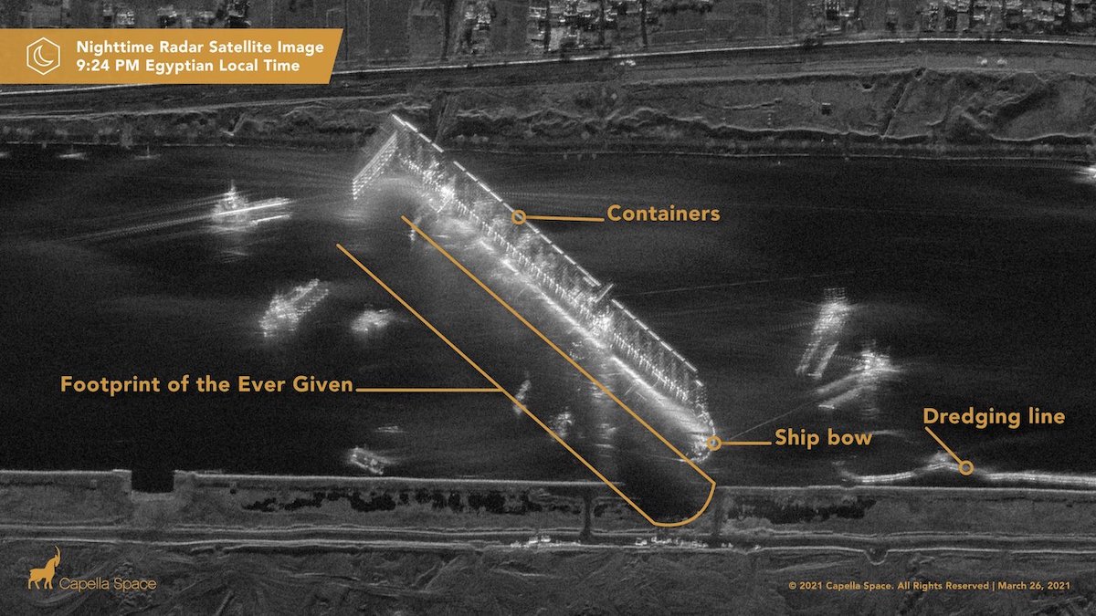
“What makes radar satellite imaging unique? It can see at night when others can’t,” Capella tweeted.
One radar image released by Capella showed the Ever Given in the Suez Canal surrounded by dredging and salvage vessels at 9:24 p.m. local time in Egypt. “No optical satellite will be able to report on this for hours,” the company tweeted.
Europe’s Sentinel surveillance and environmental monitoring satellites also observed the situation in the Suez Canal.
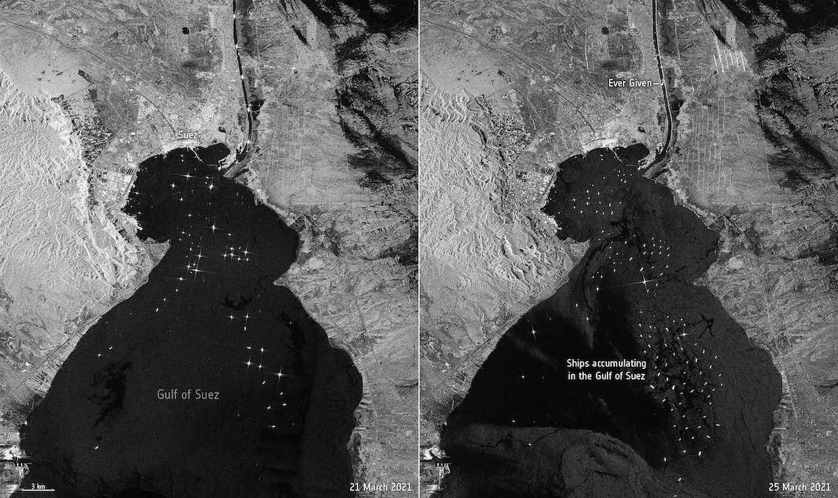
While companies like Maxar, Airbus, Planet, BlackSky, and Capella sell their imagery to customers, the Sentinel satellites are owned by the European Commission. The Sentinels collect imagery and data for public distribution free of charge.
The radar instruments on Europe’s two Sentinel 1 satellites spotted numerous cargo vessels gathered in the Gulf of Suez on March 25 waiting to enter the canal.
Email the author.
Follow Stephen Clark on Twitter: @StephenClark1.


