India’s Polar Satellite Launch Vehicle lifted off Thursday and deployed in orbit a hyperspectral Earth-imaging satellite designed to assess vegetation, soil conditions and pollution in rich detail, then maneuvered to a lower altitude to release 30 more smallsats, including reinforcements for Planet and Spire’s commercial Earth-observing constellations.
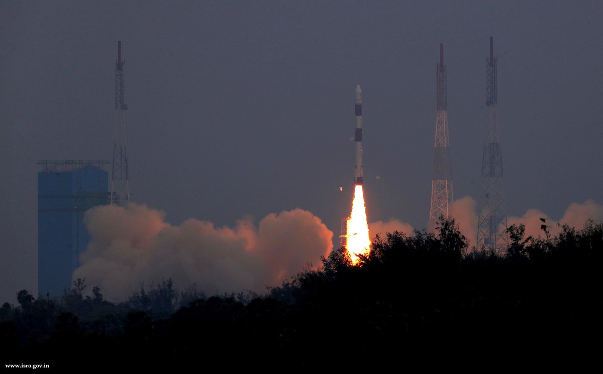
The 144-foot-tall (44.4-meter) rocket blasted off at 0427:30 GMT Thursday (11:27:30 p.m. EST Wednesday) from the Satish Dhawan Space Center on Sriharikota Island, located on India’s east coast around 50 miles (80 kilometers) north of Chennai.
Liftoff occurred at 9:57 a.m. Thursday local time in India, and the PSLV rocketed off its launch pad toward the southeast, propelled by more than a million pounds of thrust from its solid-fueled first stage motor.
The first stage burned out and jettisoned less than two minutes after liftoff from Sriharikota, and the PSLV’s second stage liquid-fueled Vikas engine ignited for a two-and-a-half minute burn. The rocket turned south from its initial southeast course, a maneuver intended to ensure the PSLV did not fly over Sri Lanka.
Another solid-fueled motor fired on the PSLV’s third stage, then a twin-engine fourth stage took over to accelerate the Indian Space Research Organization’s Hyperspectral Imaging Satellite, or HysIS, into an orbit around 395 miles (636 kilometers) above Earth, with a ground track inclined 97.96 degrees to the equator.
The 837-pound (380-kilogram) HysIS satellite separated from the PSLV’s fourth stage approximately 17 minutes after liftoff as the rocket headed south over the Indian Ocean. An on-board camera showed the HysIS spacecraft flying away from the rocket in orbit.
The PSLV’s upper stage continued its flight, flying over Antarctica before reigniting two more times to lower its altitude to roughly 313 miles (504 kilometers), setting the stage for deployment of 30 more spacecraft.
The lower orbit targeted for release of the 30 secondary payloads is expected to ensure the satellites are pulled back to Earth for destructive re-entries in the coming decades, and they do not become a source of long-term space debris.
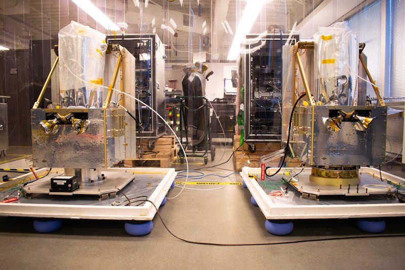
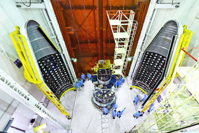
The 30 smallsats aboard the PSLV mission, codenamed PSLV-C43, included 16 Flock-3r Dove CubeSats, each about the size of a shoebox, built and owned by Planet, a San Francisco-based company with a fleet of more than 100 smallsats dedicated to Earth-imaging.
Going into Thursday’s launch, Planet had 118 active satellites in its fleet, a number that was expected to grow to 134 with the spacecraft delivered to space by the PSLV, according to Trevor Hammond, a spokesperson for the company. Five more Planet-owned spacecraft are slated to launch no earlier than Sunday on a rideshare mission aboard a SpaceX Falcon 9 rocket, further adding to an imaging network that aims to map the entire globe every day.
Another four satellites aboard the launch were from Spire Global, another San Francisco company. The four shoebox-sized Lemur-2 CubeSats, built in Scotland, joined Spire’s constellation of multipurpose commercial weather monitoring and ship tracking satellites.
Two of the Lemur-2 CubeSats are part of a European Space Agency Pioneer program to assess the usefulness of Spire’s commercial weather satellites, which use refracted GPS signals passing through the atmosphere to measure temperature, pressure and humidity.
Weather services want to make sure the Spire satellites — which also monitor ship and aircraft movements — produce useful data that can improve weather forecasts and climate change predictions. If they do, agencies could purchase Spire’s data to incorporate into weather prediction models.

“Spire has been focused on developing unique data sources with high frequency updates for the entire Earth and has over 60 Lemur-2 class satellites deployed in space complimented with a global ground station network,” said Peter Platzer, Spire’s CEO. “Under Pioneer, we can offer our extensive experience in manufacturing and managing small spacecraft like these to those who cannot afford to waste money and time doing it themselves. This work with ESA helps further support the global development of commercial aerospace’s potential to make space access universal.”
NOAA has also selected Spire for a pilot program to evaluate the company’s data for U.S. meteorologists.
BlackSky, a subsidiary of Seattle-based Spaceflight Industries, launched a 123-pound (56-kilogram) Earth-imaging microsatellite on the PSLV. The BlackSky Global 1 satellite is a follow-up to a pathfinder craft launched in 2016 to test out technology for the company’s planned fleet of commercial Earth observation satellites.
BlackSky Global 1 was the biggest of the PSLV’s secondary payloads.
“This is an important milestone for Spaceflight Industries and for our BlackSky geospatial information business,” said Jason Andrews, chairman and CEO of Spaceflight Industries, in a press release earlier this year. “Qualifying the Global generation of spacecraft paves the way for mass production and launch of our full constellation, as well as achieving our vision of deploying a high revisit rate constellation in the near future.”
The second BlackSky Global satellite is scheduled for launch Sunday from California on the same Falcon 9 rocket as Planet’s next five satellites.
Another California-based company, GeoOptics, also launched a small satellite for its own commercial weather monitoring constellation, which monitors GPS navigation signals passed through the atmosphere to measure temperature and moisture profiles. The GeoOptics CICERO 8 satellite weighs around 22 pounds (10 kilograms).
The HSAT 1 CubeSat, funded by Harris Corp., will test a deployable antenna design for potential use on future smallsats.
A CubeSat named CASE owned by Kepler Communications, a Canadian company, also hitched a ride to orbit. CASE is a testbed for Kepler’s planned constellation of commercial data relay nanosatellites in low Earth orbit.
Fleet Space Technologies, an Australian company with plans to build its own network of tiny tracking and data relay satellites designed to connect with devices in remote locations on Earth, also launched its third test CubeSat, named Centauri 1.
A Dutch company named Hiber Global is pursuing a similar data connectivity market, and its first tech demo CubeSat — Hiber 1 — was aboard the PSLV.
The Colombian Air Force’s first satellite, FACSAT 1, launched Thursday carries a medium-resolution Earth-imaging camera on a toaster oven-sized spacecraft bus.
The Finnish company Reaktor Space Lab launched its first satellite, a CubeSat, with a prototype infrared hyperspectral imager, the first of its kind to fly on such a small commercial spacecraft.
The Malaysian-built InnoSat 2 CubeSat and 3Cat 1, developed by students at Universitat Politècnica de Catalunya in Barcelona, were also launched Thursday.
The launch marked the first from India with satellites for Australia, Colombia, Malaysia and Spain. With Thursday’s mission, the PSLV has launched 45 times — 43 of which were successful — and carried 269 spacecraft to orbit for international customers, plus 53 Indian spacecraft.
The smallsats placed in orbit Thursday were expected to radio their owners in the hours after launch.
Indian officials confirmed the HysIS Earth-imaging satellite was health following launch, and its solar panels unfurled to begin generating electricity for the craft’s five-year mission.
Equipped with an Earth-facing imager capable of collecting data at 316 bands across the visible, near-infrared and shortwave infrared spectra, HysIS will take pictures rich in detail, allowing analysts to distinguish between soil and vegetation types, pollution and urban infrastructure.
ISRO says the satellite will be useful in agriculture, forestry, soil and geological surveys, coastal zone surveillance, environmental monitoring and pollution detection.
K. Sivan, ISRO’s chairman, said HysIS is a “satellite with state-of-the-art technology.”
“The heart of the system required for the Hyperspectral Imaging Satellite is basically the optical imaging detector chip,” Sivan said in remarks after the launch. “This chip was indigenously designed and devleoped by the Space Applications Center of ISRO.”
The second part of the mission was for our customers,” Sivan continued. “The way the PSLV injected all our customer satellites in their designated home, I’m sure that our customers are very happy to see their babies delivered to the their home safely and precisely.”
In addition to its role on the BlackSky Global 1 satellite, Spaceflight Industries also arranged for the launch of 12 of the secondary payloads with Antrix, ISRO’s commercial arm.
Thursday’s launch was the second in 15 days for ISRO, following the launch of a GSLV Mk.3 rocket and the GSAT 29 communications satellite Nov. 14 from Sriharikota. It was also the sixth Indian space launch of the year, and the fourth PSLV flight of 2018.
Two more Indian space missions are planned before the end of the year, beginning with the Dec. 4 launch of the GSAT 11 communications satellite, the heaviest spacecraft ever built in India. GSAT 11 will launch aboard a European Ariane 5 rocket from French Guiana.
An Indian Geosynchronous Satellite Launch Vehicle — the GSLV Mk.2 — being prepared for launch from Sriharikota in mid-December carrying the GSAT 7A data relay satellite for the Indian Air Force.
Email the author.
Follow Stephen Clark on Twitter: @StephenClark1.