Europe’s Sentinel 3B environmental satellite was shipped to the Plesetsk Cosmodrome in Russia’s far northern Arkhangelsk region in March for a month-long campaign to prepare the spacecraft for liftoff aboard a Rockot launcher.
The remote military base, nestled in a forest around 500 miles (800 kilometers) north of Moscow, is Russia’s primary launch site for satellites heading into polar orbit.
The 95-foot-tall (29-meter) Rockot booster, derived from the Soviet-era UR-100N, or SS-19, ballistic missile, will send the Sentinel 3B satellite into orbit at 1757:38 GMT (1:57:38 p.m. EDT). The satellite, built by Thales Alenia Space, weighs approximately 2,600 pounds (1,200 kilograms) fully fueled for launch.
Sentinel 3B carries four instruments to track changes in the oceans, chart vegetation growth, detect pollution and wildfires, and measure sea level and the thickness of polar ice sheets.
The Copernicus Earth observation network is the world’s most ambitious environmental satellite fleet, and Sentinel 3B is the seventh spacecraft to launch in the multibillion-euro program, which is funded by the European Commission, the European Union’s executive body.
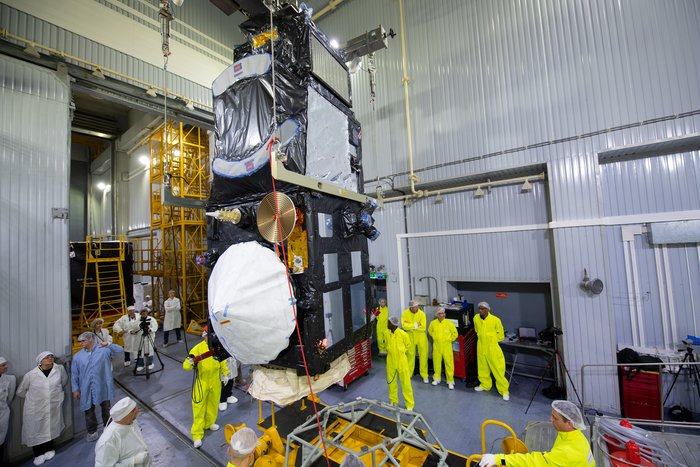
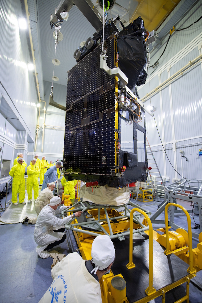
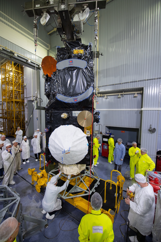
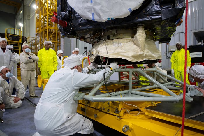
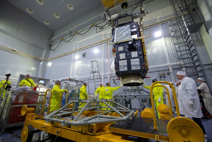
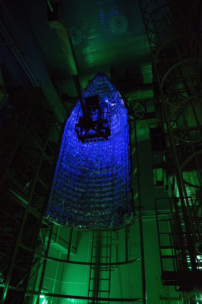
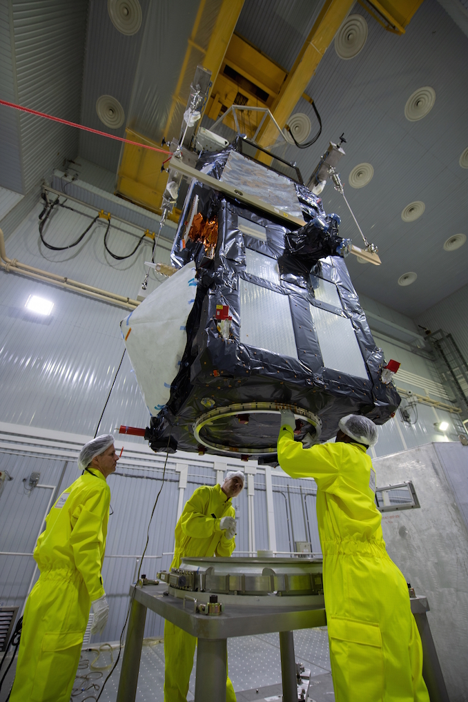
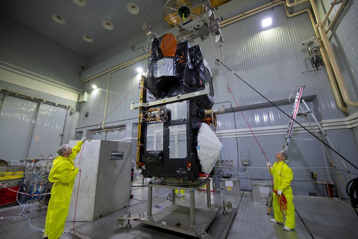
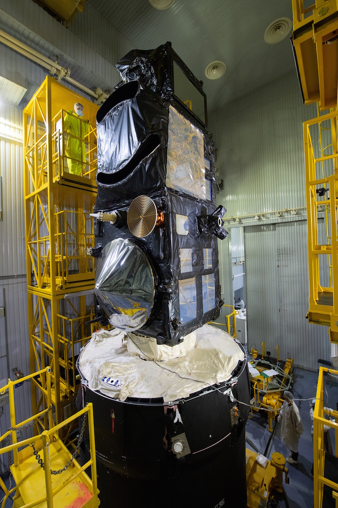
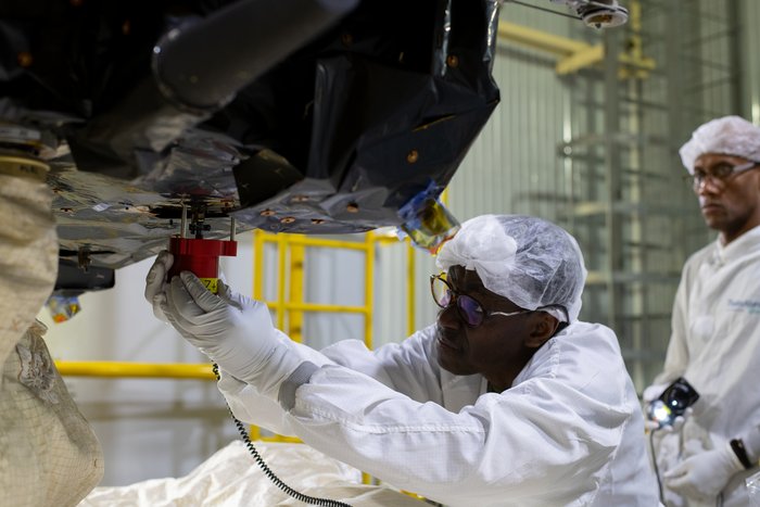
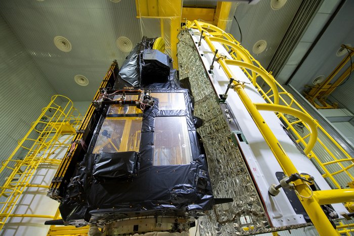
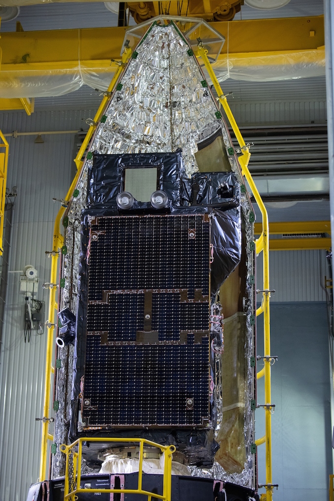
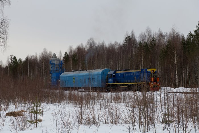
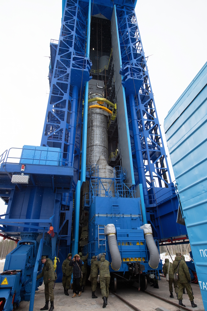
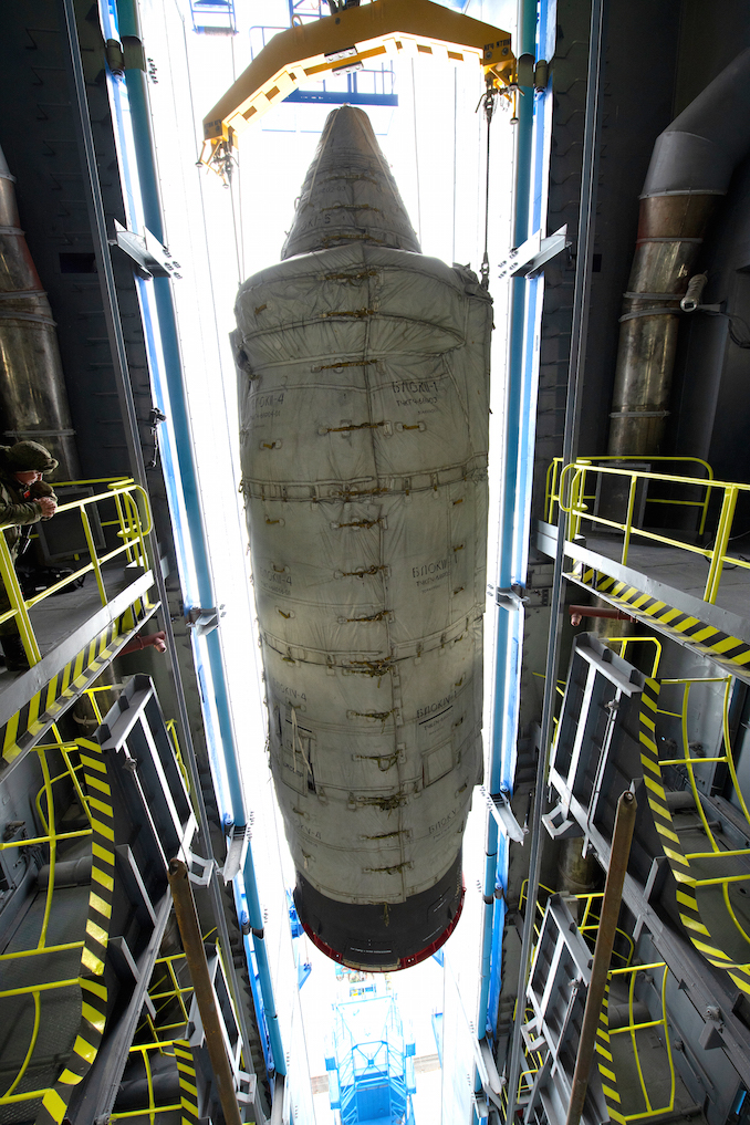
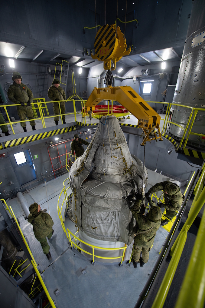
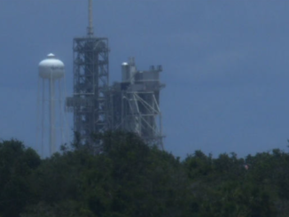
The spacecraft arrived at the Plesetsk Cosmodrome on March 18 after shipment from its factory in Cannes, France, via an Antonov An-124 cargo plane. After its arrival at Plesetsk, Sentinel 3B was unpacked, tested, fueled, mated with its Breeze KM upper stage, encapsulated inside its payload fairing, then transported to the Complex 133 launch pad for lifting atop the Rockot booster.
These photos show the satellite’s preparations at Plesetsk.
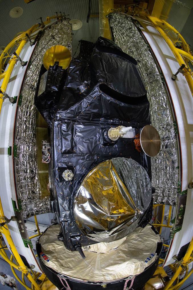
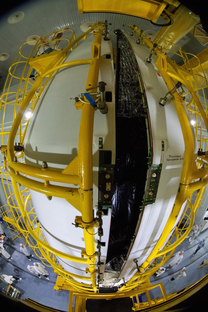
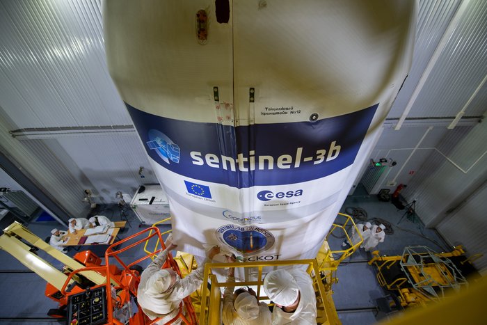
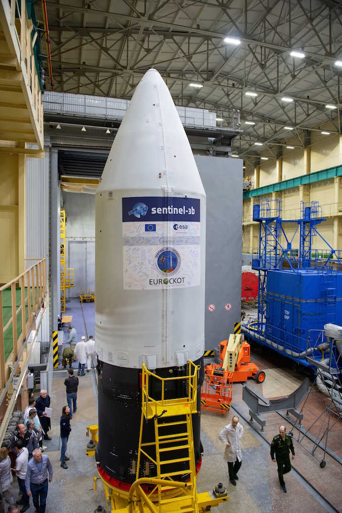
Credit: ESA – S. CorvajaCredit: ESA – S. CorvajaCredit: ESA – S. CorvajaCredit: ESA – S. CorvajaCredit: ESA – S. CorvajaTechnicians perform a black-light inspection on the Rockot’s fairing, which will enclose the Sentinel 3B satellite during launch. Credit: ESA – S. CorvajaThe Sentinel 3B spacecraft is mated to its adapter with the Rockot launch vehicle. Credit: ESA – S. CorvajaThe Sentinel 3B spacecraft is mated to its adapter with the Rockot launch vehicle. Credit: ESA – S. CorvajaThe Sentinel 3B satellite, now mounted on its payload adapter and Breeze KM upper stage, is prepared for encapsulation inside the Rockot fairing. Credit: ESA – S. CorvajaA technician removes the final ground support equipment from the Sentinel 3B satellite before its encapsulation inside the payload fairing. Credit: ESA – S. CorvajaThe Sentinel 3B satellite, now mounted on its payload adapter and Breeze KM upper stage, is prepared for encapsulation inside the Rockot fairing. Credit: ESA – S. CorvajaThe Sentinel 3B satellite, now mounted on its payload adapter and Breeze KM upper stage, is prepared for encapsulation inside the Rockot fairing. Credit: ESA – S. CorvajaThe Sentinel 3B satellite, now mounted on its payload adapter and Breeze KM upper stage, is prepared for encapsulation inside the Rockot fairing. Credit: ESA – S. CorvajaThe two halves of the Rockot fairing are closed around the Sentinel 3B spacecraft. Credit: ESA – S. CorvajaTechnicians apply the mission sticker to the Rockot fairing. Credit: ESA – S. CorvajaThe Sentinel 3B spacecraft, with its payload fairing now bearing the signatures of members of its ground team, is ready for the move to the launch pad. Credit: ESA – S. CorvajaNow cocooned in thermal insulation, the Sentinel 3B satellite inside its fairing is transported to the Complex 133 launch pad at the Plesetsk Cosmodrome. Credit: ESA – S. CorvajaThe Sentinel 3B spacecraft arrives at the base of the Rockot launch pad’s mobile gantry. Credit: ESA – S. CorvajaThe Sentinel 3B spacecraft is raised into the launch tower. Credit: ESA – S. CorvajaRussian military crews complete the attachment of the Sentinel 3B spacecraft atop its Rockot launcher. Credit: ESA – S. Corvaja
A Brazilian television broadcasting satellite and Europe’s next weather observatory packaged atop an Ariane 5 rocket lifted off at 2142 GMT (5:42 p.m. EDT) Wednesday from Kourou, French Guiana.
SpaceX’s next Falcon 9 rocket arrived at launch pad 39A Thursday for a customary hold-down engine firing. Liftoff from Florida’s Space Coast is targeted for Sunday, weather permitting.
A United Launch Alliance Atlas 5 rocket fired into space Thursday from Cape Canaveral with a $1.1 billion U.S. Air Force communications satellite, delivering fresh capacity for the military’s voice, video and data relay networks.