CAPE CANAVERAL — On the cusp of advancing U.S. weather forecasting, a powerful new satellite was shipped from its Denver factory to the Cape today in preparation for launch in November.
The first-of-its-kind observatory dubbed GOES R was flown aboard an Air Force C-5 transport aircraft from Lockheed Martin to the Kennedy Space Center to initiate its launch campaign.
Liftoff aboard a United Launch Alliance Atlas 5 rocket is planned for Nov. 4 at 5:40 p.m. EDT (2140 GMT) from Cape Canaveral’s Complex 41. The daily launch window extends 120 minutes.
The Geostationary Operational Environmental Satellite R will orbit 22,300 miles above the equator in lockstep with the Americas to provide unprecedented new weather-forecast tools.
GOES R, plus three future sister-satellites, is a collaborative project between NASA — which ordered the spacecraft, instruments and launchers — and operator NOAA. Lockheed Martin built the craft.
“It will provide continuous imagery and atmospheric measurements of Earth’s western hemisphere, and also support space weather prediction,” said Sandra Smalley, head of NASA’s Joint Agency Satellite Division.
“It’s the next generation (of GOES satellites) providing a major improvement in quality, quantity and timeliness of the data collected. Overall, it will provide visual and IR imagery, lightning mapping, space weather monitoring and solar imaging. It will accomplish all of this using six instruments.”
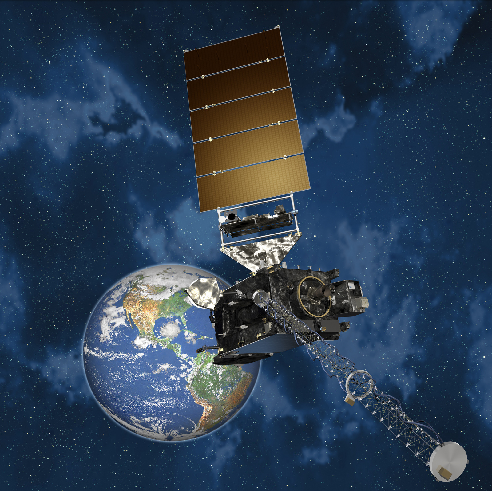
The primary instrument — the Advanced Baseline Imager — will show the motion of clouds and weather systems in visible and infrared bands that television meteorologists use in newscasts. The instrument will monitor water vapor, measure land and sea surface temperature and depict rainfall rates.
It will produce real-time estimates of central pressure and maximum sustained winds for tracking the intensity of hurricanes, and measure the key ingredients of severe weather like winds, cloud growth and lightning to improve tornado warnings.
The ABI will collect three times more data at four times better resolution while providing more than five times faster coverage than current GOES satellites, NOAA says.
GOES R also carries the first Geostationary Lightning Mapper. It will use a high-speed camera to detect in-cloud and cloud-to-ground lightning over the Americas and surrounding ocean areas. GLM promises to increase the warning time for severe weather.
GOES R also has instruments to monitor the Sun, detect solar storm eruptions and alert when the space weather arrives at Earth. Such storms can impact communications, disrupt power grids, threaten the health of astronauts and harm satellites.
The Atlas 5 rockets that will launch GOES R — and GOES S in 2018 — will fly in the 541 configuration with a five-meter fairing, four solid rocket boosters and a single-engine Centaur upper stage.
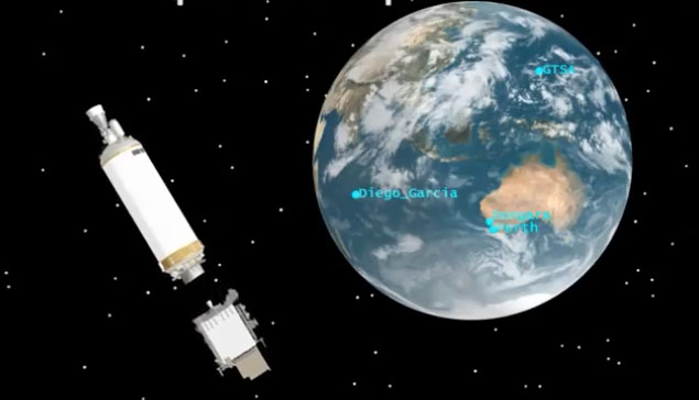
A three-hour ascent featuring three burns by the Centaur will deliver the craft into a customized high-perigee geosynchronous transfer orbit of 3,600 by 22,000 miles at 12.9 degrees inclination. Five burns of the satellite’s main engine will bring the craft to geostationary orbit within 8 days of launch.
“They are huge satellites. GOES R is getting ready to launch, so it’s fully integrated, and GOES S is well along the way,” said Smalley.
“GOES R has had some technical challenges, so (GOES) S has basically been used as a spares spacecraft for (GOES) R, but they’ve made great progress.”
After touching down at the Shuttle Landing Facility at 3:16 p.m. today, the satellite will be taken to the commercial Astrotech processing facility in Titusville this evening to be unboxed from its shipping container for the start of final testing, fueling and encapsulation.
“This milestone is a great achievement for the entire GOES-R team, who have worked tirelessly to get the spacecraft to Florida,” said Greg Mandt, NOAA’s GOES R system program director. “Moving forward, we are focused on preparing this highly advanced weather satellite for its historic launch in just a few short months.”
GOES R will be renamed GOES 16 once it reaches geostationary orbit. Initially, controllers position the satellite at 89.5 degrees West longitude for an extensive year-long checkout and validation. It then awaits call-up to replace either the GOES West or GOES East operational observatories covering the U.S.
The GOES program dates back to 1975. Unlike today’s three-axis stabilized satellites, the first GOES were spin-stabilized and viewed Earth only about ten percent of the time.

The GOES R, S, T and U series is expected to sequentially extend geostationary weather satellite operations to 2036. Each satellite is capable of five years in-space storage and 10 years of use.
GOES T launches in 2019 and GOES U follows in 2024. Launch vehicles have not yet been assigned to those two spacecraft.
Currently, GOES 15 is the GOES West satellite at 135 degrees West longitude. It was launched as GOES P atop a Delta 4 rocket in 2010. GOES 13 — launched as GOES N in 2006 — is the GOES East satellite at 75 degrees West. The GOES 14 launched in 2009 as GOES O serves as the in-space spare, ready to be pressed into service at a moment’s notice.
Our Atlas archive.