
Satellites and astronauts orbiting Earth have been tracking the eruption of a volcano on the Spanish island of La Palma for the last three weeks, revealing a red-hot river of lava pouring out of the ground and flowing into the Atlantic Ocean.
The rare views from orbit of an erupting volcano come from a fleet of government and commercial remote sensing satellites, and from astronauts watching from the International Space Station.
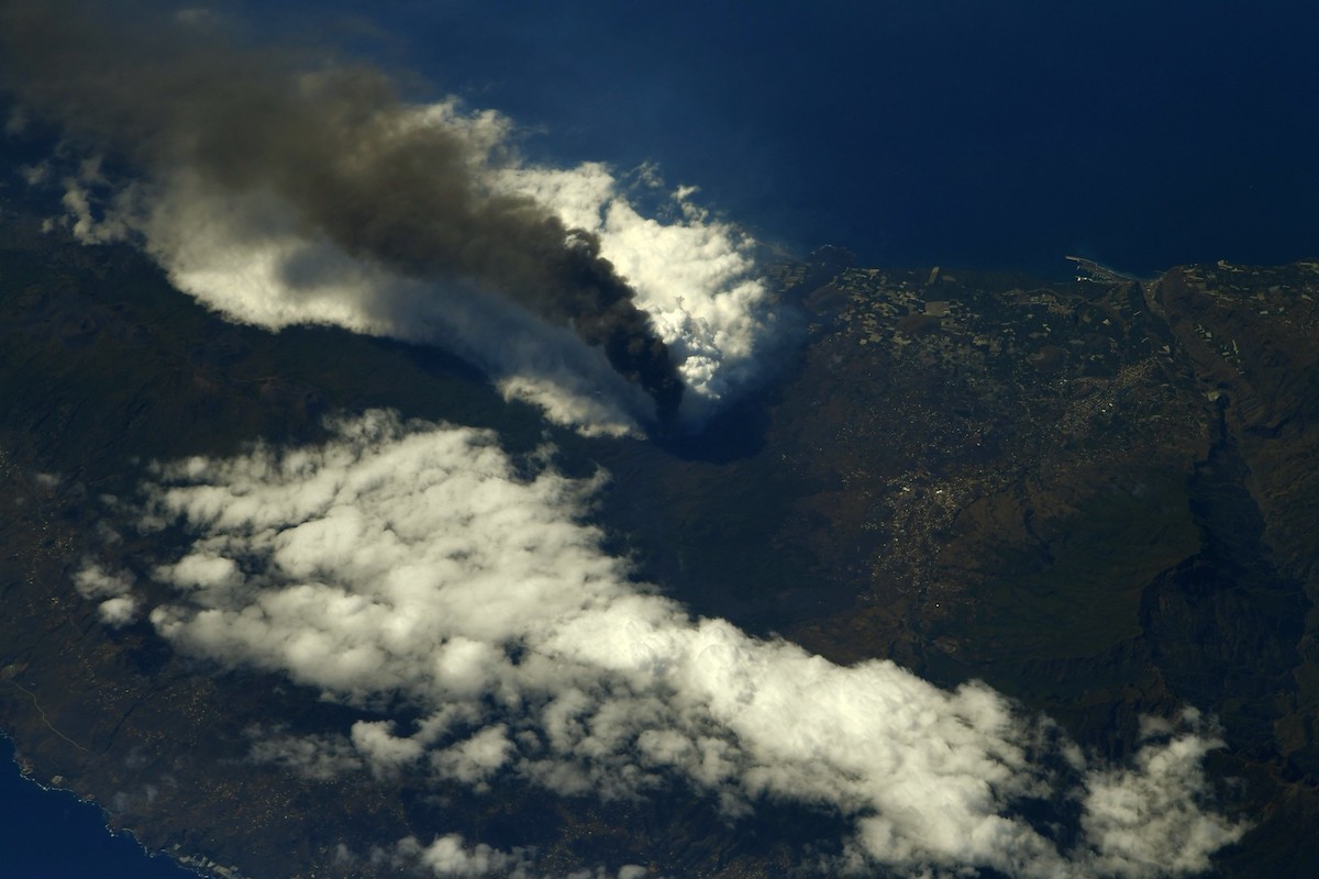
The U.S. government’s Landsat 8 satellite, which specializes in wide-angle multi-color views of Earth’s land surfaces, spotted the Cumbre Vieja volcano in a spectacular image captured Sept. 26. The spacecraft’s instruments imaged La Palma, located in the Canary Islands, in visible and infrared wavelengths, simultaneously showing the volcano’s plume of smoke and ash blowing out to sea, and the destructive lava flow heading the opposite direction across the island’s landscape.
The Cumbre Vieja volcano began erupting Sept. 19 after a series of precursor earthquakes, forcing the evacuation of more than 6,000 people. As of Oct. 8, the lava flow had affected more than 1,200 acres (497 hectares) of land and destroyed more than 1,100 buildings.
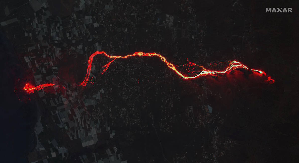
The optical camera on Maxar’s WorldView 3 high-resolution imaging satellite recorded sharper views of the volcano. One of the images, taken Sept. 30 from an altitude of 379 miles (610 kilometers), shows the lava flow snaking across La Palma before emptying into the Atlantic Ocean.
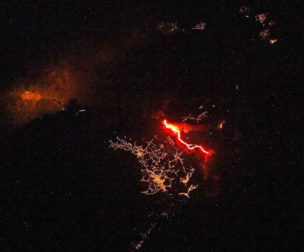
Astronauts on the International Space Station have also observed the Cumbre Vieja volcano from their perch some 260 miles (420 kilometers) above the planet.
European Space Agency astronaut Thomas Pesquet shared several views of the volcano, most recently Oct. 4.
“Bright orange lava sticks out an night, and drak grey smoke and ash sticks out during the day,” Pesquet tweeted. “The #LaPalma volcano in the Canary Islands is making itself known to the world. #TodosConLaPalma”
Russian cosmonaut Oleg Novitskiy also tweeted a nighttime view of the bright river of lava flowing from Cumbre Vieja.
Other satellites, such as the European Sentinel 5P remote sensing observatory, track gases in Earth’s atmosphere. Sentinel 5P data captured Oct. 6 showed concentrations of sulfur dioxide from the volcano blowing away from La Palma over the Atlantic Ocean toward Central America.
The atmospheric measurements from space help airplanes steer clear of ash and toxic gas plumes.
Satellites can also be used after volcanic eruptions and other natural disasters to assess damage.
Email the author.
Follow Stephen Clark on Twitter: @StephenClark1.