
Less than three months after rocketing into space, the commercial WorldView 4 Earth-imagery satellite has finished in-orbit testing and calibration to begin operations for DigitalGlobe.
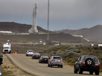
To commemorate the milestone, the company has released a stunning image taken from space of the United Launch Alliance Atlas 5 blasting off with WorldView 4 on Nov. 11 from Vandenberg Air Force Base, California.
The picture was snapped by WorldView 2, which launched from the same base atop a Delta 2 booster in 2009. The image was captured as WorldView 2 was 396 miles (637 km) northeast of Vandenberg and 38 degrees off-nadir, according to DigitalGlobe.
At the moment the image was taken, the Atlas 5 was powering away from the Space Lauch Complex 3-East pad on 860,000 pounds of thrust.
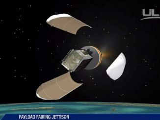
Just 19 minutes later, the rocket released WorldView 4 into a sun-synchronous orbit to circle the planet every 97 minutes and join DigitalGlobe’s fleet of high-resolution observatories.
WorldView 4 is the new companion to WorldView 3, effectively doubling the amount of best-on-the-market imagery with unmatched 30-cm resolution.
WorldView 3 is booked by U.S. government contracts. WorldView 4 will enable DigitalGlobe sales to foreign allies and commercial uses like agriculture, mining, land developers and oil and gas firms.
“Meeting our commitment to delivering WorldView 4 access on time for our customers is a tremendous achievement,” said Tim Hascall, DigitalGlobe EVP and chief operations officer.
“We look forward to making WorldView 4’s capabilities available to all of our customers, helping them to make critical decisions with confidence for many years to come.”

See full image here.
From its orbit 383 miles (617 km) high, WorldView 4 is designed to see objects as small as 1-foot-wide (31 cm) in panchromatic mode and has a color capability with 4-foot resolution (1.24 m). It will image 263,000 square miles (680,000 square km) of the Earth’s surface per day.
“Imagery with this level of detail enables users to reliably read street markings, distinguish between cars, trucks and vans, and confidently understand activities of significance,” DigitalGlobe says.
The craft uses the Global Positioning System satellite network and onboard star trackers to determine its precise location in orbit relative to the spot on Earth being observed. The imaging options include shooting targeted scenes, large-area collections or long, narrow strips of land.
Built by Lockheed Martin, WorldView 4 stands 18 feet (5.5 meters) tall and has a wingspan of 26 feet (8 meters) with the five power-generating solar arrays extended.
Harris Corp., which built the camera system on WorldView 4, says the primary mirror was manufactured to an accuracy of 1/1000th of a human hair. It has an aperture of 3.6 feet (1.1 meters).
Control Moment Gyroscopes will enable superior agility for the satellite, allowing it to slew in just 10.6 seconds from one target to another 125 miles (200 km) away.
It features a 3200-Gb solid state onboard storage capability and will communicate with the ground via X-band for data transmissions and S-band for control functions.
See earlier WorldView 4 coverage.
Our Atlas archive.
