STORY WRITTEN FOR CBS NEWS & USED WITH PERMISSION
A SpaceX Falcon 9 rocket launched a $1.2 billion NASA satellite early Friday to monitor Earth’s oceans, rivers and lakes with a high-power radar and other sensitive instruments to better assess the movement of the planet’s water and the impacts of climate change.
It was the first of three planned launches in two days for the California rocket builder, including a flight to put two SES communications satellites in orbit Friday afternoon and another to launch 54 Starlink internet relay stations Saturday. That flight will use a first stage booster making a record 15th flight.
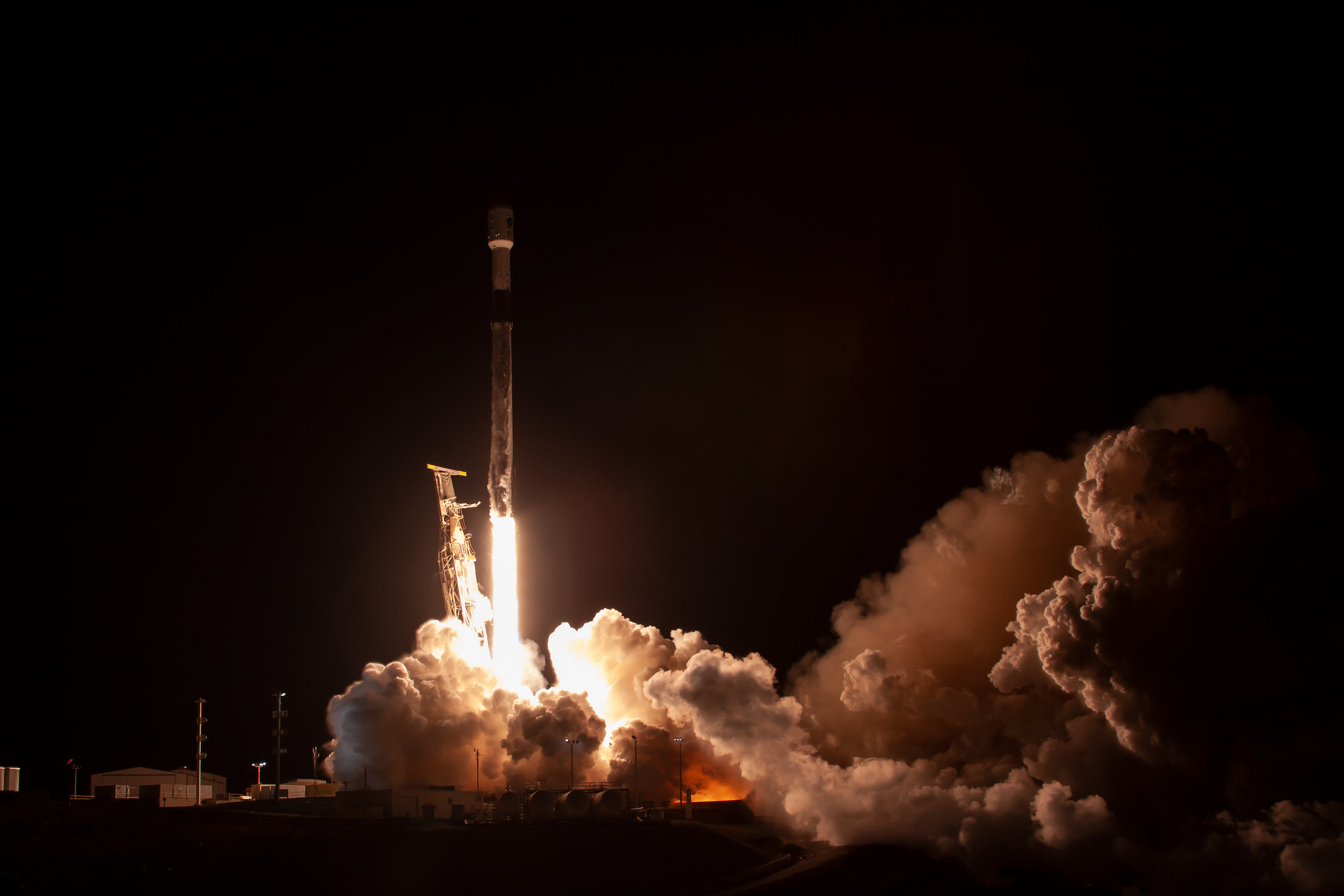
The triple header started in California before dawn Friday with launch of the Surface Water and Ocean Topography — SWOT — spacecraft, an international project led by NASA with participation from the French space agency (CNES), Canada and the United Kingdom.
The satellite is designed to measure the height of water across 70 percent of the planet every three weeks, generating a terabyte of data per day.
“Earth is a water planet, and SWOT will bring us a revolutionary advance in our understanding of how water moves around our planet,” said Karen St. Germain, director of NASA’s Earth Science Division.
“It starts in the oceans, it gets delivered to land through the atmosphere and eventually returns to the oceans. That’s the water cycle. And as our climate is changing, the water cycle is amplified.”
That means many areas that are wet are getting wetter, she said, and areas that are dry are getting drier.
In areas where too much water is a problem, “SWOT will help us understand how that water is moving and get better at predicting when there may be inundation, whether it’s flooding in a coastal community from a storm surge, or vulnerability to flooding due to severe weather inland,” St. Germain said.
In areas that are getting drier, she added, SWOT’s high-resolution measurements “can be a really critical piece of information for smart management of water, whether that’s for food production or just to support local communities.”
The mission began at 6:46 a.m. EST (3:46 a.m. local time) when the Falcon 9 rocket’s first stage engines thundered to life with a rushing jet of flaming exhaust, lighting up the pre-dawn sky as the booster climbed away from Vandenberg Space Force Base northwest of Los Angeles.
Launch originally was planned for Thursday, but the flight was delayed one day to give engineers more time to assess the first stage rocket engines for possible water intrusion in the wake of torrential rains. No problems were found, and the rocket was cleared for launch.
After boosting the 4,850-pound SWOT satellite out of the lower atmosphere, the first stage, making its sixth flight, flipped around and headed back to a landing pad at Vandenberg, chalking up SpaceX’s 156th booster recovery and its seventh in California.
After two firings of the second stage engine, SWOT was released in a 530-mile-high orbit carrying it around the planet 14 times a day, passing over every point on Earth between 78 degrees north and south latitude.
The satellite features two large solar arrays and a sophisticated Ka-band Radar Interferometer, dubbed KaRin, featuring two antennas that will extend opposite each other, separating to a distance of 30 feet. Each antenna will collect data over two 30-mile-wide swaths to either side of the satellite.
Radar pulses beamed down at the surface will be reflected back toward SWOT. By measuring slight differences in the arrival times and angles of the reflected beams, computer software can derive the height of the water below.
Another instrument, an Earth-facing altimeter, will measure water height directly below the SWOT spacecraft and a microwave radiometer will collect data allowing scientists to correct for the effects of water vapor, which affects the propagation of radar beams.
The mission also utilizes additional equipment to measure SWOT’s altitude and velocity with extreme precision, a requirement for accurately deriving water height from KaRin and the Earth-facing altimeter.
“The data from SWOT will inform communities around the world, from water managers and agriculture producers inland to coastal communities who are dealing with increased risk of flooding and disaster planning and preparedness,” said St. Germain.
Along with providing high-resolution data on ocean height, “we’ll go from being able to see a couple of thousand inland water bodies, lakes and reservoirs to millions,” she said. “So an enormous positive impact for those who rely on knowledge of water levels inland to manage water for everything from agriculture to human consumption.”
NASA’s cost for the SWOT mission came to $807.4 million. The French space agency — the Centre National d’Études Spatiales (CNES) — spent $363 million, Canada chipped in $11.4 million and the United Kingdom another $15 million. The mission is expected to last at least three years.