|
 |
|
||||
|
|
||||
|
The Aqua observatory NASA PRESS KIT Posted: May 1, 2002
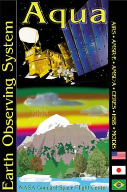
Aqua, Latin for "water," is named for the large amount of information that the Aqua spacecraft will collect about the Earth's water cycle. In particular, the Aqua data will include information on water vapor and clouds in the atmosphere, precipitation from the atmosphere, soil wetness on the land, glacial ice on the land, sea ice in the oceans, snow cover on both land and sea ice, and surface waters throughout the world's oceans, bays, and lakes. This information will help scientists improve the quantification of the global water cycle and examine whether or not the cycling of water might be accelerating. In addition to information about the water cycle, Aqua will enable studies of the intensity of radiation from the Sun and from the Earth that combine to constitute the Earth's radiation balance. It also will enable studies of small particles in the atmosphere, termed "aerosols," and trace gases such as ozone, carbon monoxide, and methane. Each of these trace gases potentially contribute to global warming, whereas the aerosols are more likely to have a cooling effect on our environment. Aqua will provide observations on vegetation cover on the land, phytoplankton and dissolved organic matter in the oceans, and the temperatures of the air, land, and water. All of these measurements will contribute to an improved scientific understanding of the changes occurring in the global climate and the role of the interactions among the various elements of the climate system. One of the most exciting of the potential practical benefits likely to derive from the Aqua data is improved weather forecasting. Aqua will carry a sophisticated sounding system that will allow determination of atmospheric temperatures around the world to an accuracy of 1 deg Celsius (1.8 F) in 1-kilometer-thick (.6 mile) layers throughout the troposphere. The troposphere is the lowest part of Earth's atmosphere and extends to an altitude of about 10-15 kilometers (6-9 miles), depending on geographic location, and contains most of the global cloud cover. The anticipated 1 deg Celsius (1.8 F) accuracy far exceeds current accuracies from satellite observations and, in conjunction with the moisture profiles also obtainable from the Aqua sounding system, will offer the potential of improved weather forecasting. NASA is working with NOAA and the European Centre for Medium-Range Weather Forecasts to facilitate the incorporation of the Aqua data into their operational weather forecasting efforts. Aqua is a joint project between the United States, Japan, and Brazil.
|
Flight Data File Vehicle: Delta 2 (7920-10L) Payload: Aqua Launch date: May 4, 2002 Launch time: 0954:58-1004:58 GMT (5:54:58-6:04:58 a.m. EDT) Launch site: SLC-2W, Vandenberg AFB, Calif. Satellite broadcast: GE-2, Transponder 9, C-band Pre-launch briefing Launch timeline - Chart with times and descriptions of events to occur during the launch. Orbit trace - Maps showing the ground track for the launch. Science goals - Aqua's science objectives and mission goals. Satellite instruments - Description of each of the six instruments on Aqua. Delta 2 rocket - Overview of the Delta 2 7920-model rocket used in this launch. SLC-2W - The launch pad where Delta rockets fly from Vandenberg. Delta directory - See our coverage of preview Delta rocket flights. |
|||||
|
MISSION STATUS CENTER |
||||||