

|
|
|
|
|
|

|
|
Inmarsat points to Indian Ocean as MH370 crash site BY STEPHEN CLARK SPACEFLIGHT NOW Posted: March 24, 2014 Engineers from Inmarsat, a London-based communications satellite operator, pioneered a 'peer-reviewed' data analysis technique using simple electronic signals from the lost Malaysian airliner that disappeared earlier this month to determine the jet crashed in the southern Indian Ocean, officials said Monday.
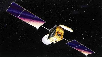
The airliner disappeared March 8 with 239 passengers and crew on-board. Assisted by the UK Air Accident Investigations Branch, Inmarsat engineers analyzed electronic 'pings' received from the lost Boeing 777 airliner nearly seven hours after its transponder stopped transmitting and it dropped off of radar. Experts initially narrowed the plane's route to a northern or southern course from its last confirmed location near Malaysia. Razak said he was briefed by British investigators Monday with new data showing Flight MH370 went south. "Based on their new analysis, Inmarsat and the AAIB have concluded that MH370 flew along the southern corridor and that its last position was in the middle of the Indian Ocean west of Perth," Razak said. "This is a remote location far from any possible landing sites. It is, therefore, with deep sadness and regret that I must inform you that according to this new data Flight MH370 ended in the southern Indian Ocean." The suspected crash site west of Perth was already the focus of intense aerial surveys after U.S., Chinese and French imaging satellites spotted debris in the Indian Ocean that may be linked to the missing airliner. Officials have not confirmed any of the objects are from the Malaysian jet. Chris McLaughlin, senior vice president of external affairs at Inmarsat, said engineers identified subtle changes in the frequency of the airliner's radio pings to track the plane's movements relative to a satellite thousands of miles above Earth. Inmarsat used the L-band signal's Doppler shift to determine the direction of Flight MH370's path. Engineers can deduce whether an object is traveling toward or away from a receiver based on the Doppler shift, similar to the change in the pitch of a siren heard when a police car passes nearby. The communication through the Inmarsat satellite contained no data on the airplane's condition or exact location, but the Doppler analysis gave investigators a general idea of the jet's movements. "Doppler shift, in very simple terms, is just the way in which we see the effect of the slight movement of the satellite in space relative to the aircraft," McLaughlin said. "From that process, [there is] a compression or an expansion of the wavelength, and you can know whether the aircraft is moving closer or farther away from the satellite. McLaughlin said Inmarsat compared data from MH370 with pings from other airliners in the region to establish a pattern. "The southern path predicted fits very much with that path that's been indicated by our pings, ruling out the northern path," McLaughlin said in an interview with CNN. "It's been a groundbreaking, but traditional mathematics-based process that was then peer-reviewed by others in the space industry, and indeed contributed to by Boeing. "By all intents and purposes ... there's no way it went north," McLaughlin said. Prime Minister Razak described Inmarsat's work as a "type of analysis never before used in an investigation of this sort." The Inmarsat 3 F1 satellite positioned 22,300 miles over the Indian Ocean detected pings from the Malaysian airliner for approximately seven hours after the jet's transponder was deactivated and it veered off its approved flight path from Kuala Lumpur to Beijing. Inmarsat specializes in linking clients beyond the reach of terrestrial communications networks, such as customers in the maritime and aviation industries, oil and gas exploration companies, and remote mining facilities. "We are both pleased that we've been able to contribute, and it would appear to offer some insight on where to look, but [we are] very saddened for the families involved," McLaughlin said. "The only thing you can hope is that, just as the Titanic resulted in the Safety of Life at Sea law, from this there will be a mandate that all aircraft should be constantly tracked." Follow Stephen Clark on Twitter: @StephenClark1. |
|
|
|
|
||||||||||||||||||||||||||||||||||||||||||||||||||||||||||||||||||||||||||||||||