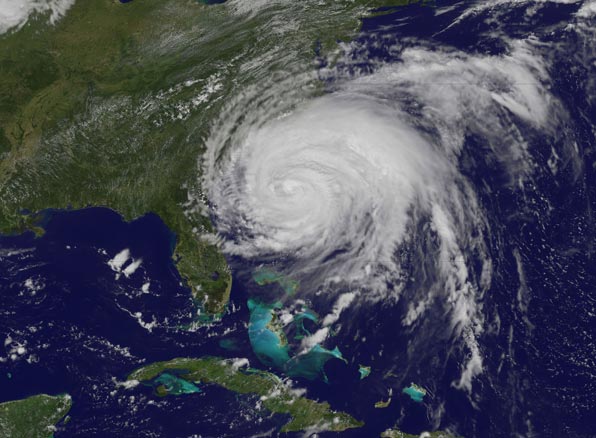
Hurricane Irene seen from spaceThis visible image of Hurricane Irene was taken from the GOES-13 satellite on August 26, 2011 at 1:40 p.m. EDT. The extent of Irene's 600 mile wide cloud cover can be seen covering a third of the U.S. east coast. Image: NASA/NOAA GOES Project
|

|