|
|
|

|
|
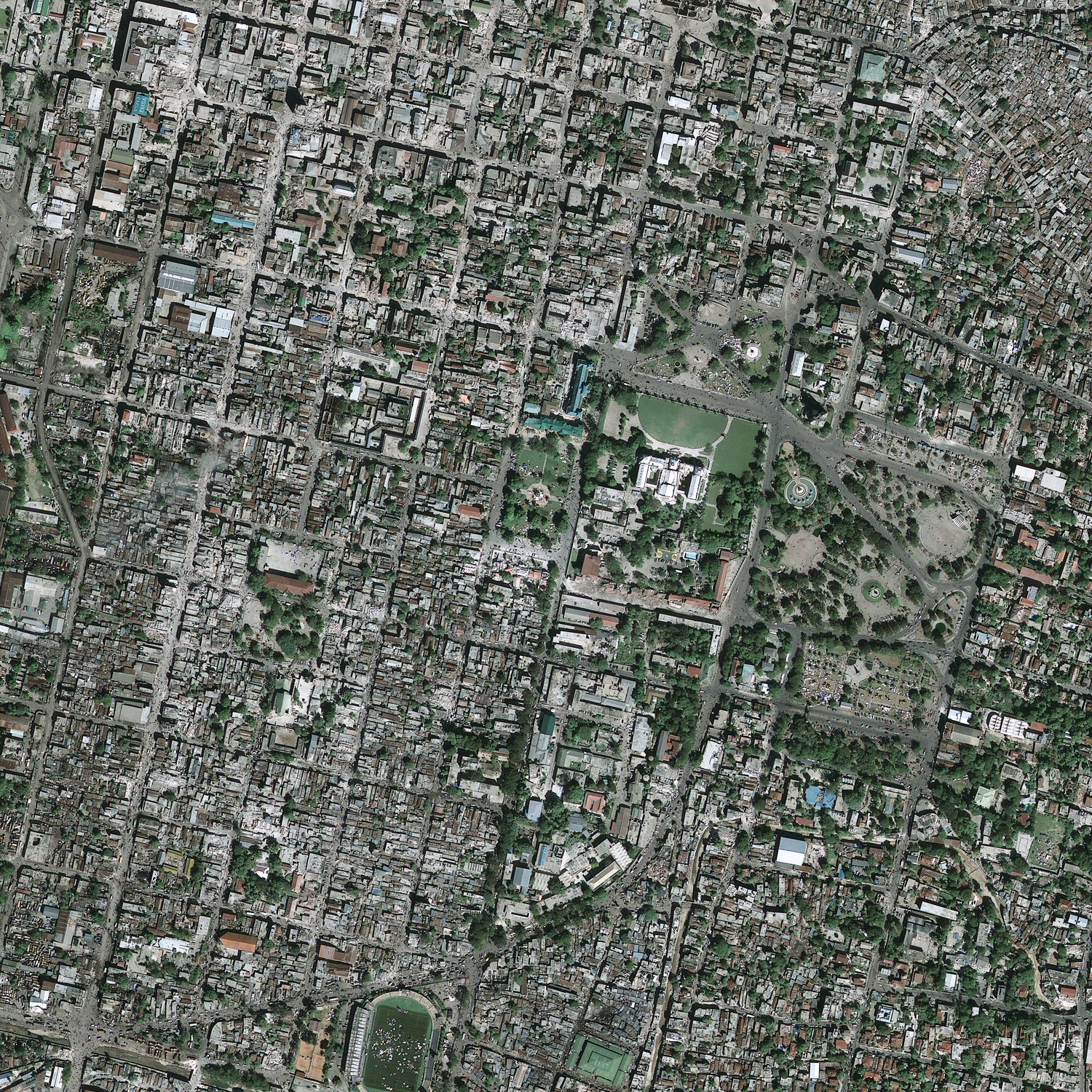
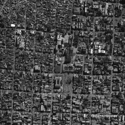
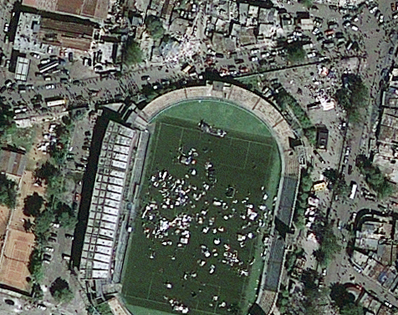
Satellite images show Haiti earthquake catastrophe BY STEPHEN CLARK SPACEFLIGHT NOW Posted: January 14, 2010 The world's space agencies and private satellite operators are capturing high-resolution imagery of earthquake-ravaged Haiti, showing catastrophic damage and crowds of displaced residents in the nation's capital city.
Earth observation satellites have now begun collecting pictures of Haiti to help rescue workers, aid missions and geologists in the aftermath of the quake. United Nations, United States, French and Canadian authorities requested optical and radar satellite data of the region following the event, according to the European Space Agency. "This is a general effort by space agencies aimed at providing assistance, even though I think it's sad to say that there's still a lot that we need to do in this area," said Jean-Jacques Dordain, ESA director general. Commercial high-resolution imaging satellties like GeoEye 1, Ikonos, QuickBird and WorldView 1 and 2 have also started taking pictures of the damage in Port-au-Prince.
Both GeoEye and DigitalGlobe, operator of the WorldView and QuickBird fleet, are providing imagery at no charge to relief workers. GeoEye imagery has also been added to Google Earth, the online mapping resource used by millions of people. "Relief workers and aid agencies need to know where things are and what has changed," Brender said. "Commercial satellite imagery provides the ultimate high shot."
"ESA's radar satellites have been programmed to take images today and tomorrow, just like the Japanese and Canadian ones," Dordain told reporters on Thursday. The worldwide satellite observation campaign was activated by the International Charter on Space and Major Disasters. A NASA spokesperson said the agency's Terra remote sensing satellite attempted to take data over Haiti on Thursday, but the pass was thwarted by clouds. Terra's orbit won't take it over Haiti again until next week. NASA is providing pre-earthquake imagery of Haiti, including Terra images and precise topography data collected during a 2000 space shuttle mission, the spokesperson told Spaceflight Now. Satellites have been launched to precisely measure variations in Earth's gravity field, vastly increasing scientists' knowledge of the planet's interior engine that drives earthquakes and volcanoes. But earthquake forecasting is still unattainable with current technology. "Space can't solve all our problems, in particular predicting the type of earthquake that killed and destroyed in Haiti," Dordain said. |
|
|
|
|
|||||||||||||||||||||||