|
 |
|
||||
|
|
||||
|
NASA computer models may lead to quake forecasts NASA NEWS RELEASE Posted: May 24, 2003 Advanced computer simulation tools now being developed by NASA and university researchers may soon give scientists new insights into the complex and mysterious physics of earthquakes and enable vastly improved earthquake forecasting.
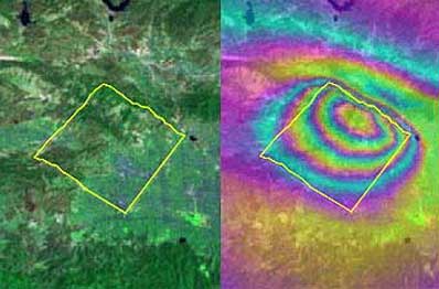
The tools are based upon the latest technologies. For example, one uses finite element analysis, which solves complex computer modeling problems by breaking them into small pieces. For QuakeSim, the finite elements are tens to hundreds of thousands of measurements of how Earth's crust deforms in response to movement of the giant tectonic plates Earth's landmasses ride upon. The measurements are gathered through both ground and space-based techniques. The latter include global positioning system and interferometric synthetic aperture radar, which measure the "quiet" (non-earthquake) motions associated with plate tectonics and the quake cycle. QuakeSim Principal Investigator Dr. Andrea Donnellan of JPL calls QuakeSim a vital step toward eventual earthquake forecasting. "The deformation of Earth's crust and the interaction between quake faults is a complex 3-D process happening on timescales of minutes to thousands of years," she said. "Studying it requires sophisticated simulation models and high-performance supercomputers. The availability of space-based data and our current limited understanding of quake processes make this an ideal time to develop a system for studying deformation processes such as tectonics, quakes and volcanoes." "New quake models developed under QuakeSim are expected to yield future earthquake forecasts that will be used by a variety of federal and state agencies to develop decision support tools that will help mitigate losses from future large earthquakes," Donnellan added. QuakeSim's three major simulation tools are Park, Virtual California and the Geophysical Finite Element Simulation Tool (Geofest). Park simulates the evolution of a quake on a single, unstable fault over time. It is based upon current knowledge of the rate of movement (or "slip") and friction on a well-studied section of the San Andreas Fault in Parkfield, Calif., but is applicable to any fault or collection of faults. Park will be the tool of choice for researchers seeking to determine the nature and detectability of quake warning signals. It will determine how stress is distributed over a fault and how it is redistributed by quakes or "quiet" seismic motion. It can also be used to compute the history of slip, slip speed and stress on a fault. Up to 1,024 computer processors will be used in parallel to demonstrate Park's capability. Virtual California simulates how California's hundreds of independent fault segments interact and allows scientists to determine correlated patterns of activity that can be used to forecast seismic hazard, especially for quakes of magnitude 6 or greater. Patterns from the simulated data are compared to patterns in real data to strengthen understanding of the quake process. The approach's potential is already being demonstrated. Under a joint NASA/Department of Energy study lead by Dr. John Rundle, director of the Center for Computational Science and Engineering at the University of California at Davis, Virtual California was used to identify regions of the state with elevated probabilities of quakes over the next decade. Since the study was completed in 2000, all of California's five largest quakes of magnitude 5 or greater have occurred within 11 kilometers (6.8 miles) of these sites. The probability of this occurring randomly is about one in 100,000. The last three of these quakes occurred after the forecast map was published in the Proceedings of the National Academy of Sciences in February 2002. Geofest creates 2-D and 3-D models of stress and strain in Earth's crust and upper mantle in a complex geologic region with many interacting fault systems. It shows how the ground will deform in response to a quake, how deformation changes over time following a quake, and the net effects to the ground from a series of quakes. The entire Southern California system of interacting faults will be analyzed, covering a portion of the crust approximately 1,000 kilometers (621 miles) on a side. The simulation will require millions of equations and hundreds of computer processors.Ā In addition to JPL, the QuakeSim team includes the Davis and Irvine campuses of the University of California; Brown University, Providence, R.I.; Indiana University; and the University of Southern California. An independent review board provides oversight. Codes will be run on supercomputers at NASA's Goddard, Ames and JPL facilities and other institutions. The California Institute of Technology in Pasadena manages JPL for NASA. NASA's Earth Science Enterprise is dedicated to understanding Earth as an integrated system and applying Earth system science to improve prediction of climate, weather and natural hazards using the unique vantage point of space. A primary goal of NASA's solid Earth science program is assessment and mitigation of natural hazards. QuakeSim supports the Enterprise's goal of developing predictive capabilities for quake hazards.
|
|
||||