|
 |
|
||||
|
|
||||
|
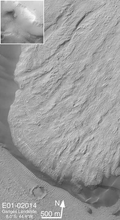
Mars orbiter sees landslide Posted: November 5, 2001 Ganges Chasma -- or Gangis Chasma (as it is sometimes spelled) -- is a several kilometers-deep side canyon at the east end of the vast Valles Marineris trough system. In several places, portions of the steep walls of Ganges Chasma have collapsed down into the chasm, creating large landslide deposits.
The box at upper left shows the landslide location in Ganges Chasma, and the 500 m scale bar equals ~547 yards. Malin Space Science Systems and the California Institute of Technology built the MOC using spare hardware from the Mars Observer mission. MSSS operates the camera from its facilities in San Diego, CA. The Jet Propulsion Laboratory's Mars Surveyor Operations Project operates the Mars Global Surveyor spacecraft with its industrial partner, Lockheed Martin Astronautics, from facilities in Pasadena, CA and Denver, CO.
|
|
||||