|
 |
|
||||
|
|
||||
|
TRMM satellite critical tool in monitoring hurricanes NASA-GODDARD NEWS RELEASE Posted: April 10, 2001
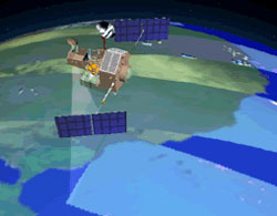
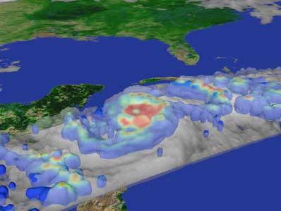
This tool, the Tropical Rainfall Measuring Mission (TRMM) satellite, was designed to provide a comprehensive account of tropical rainfall and its implications for climate. Yet, the versatility of the TRMM satellite and its unique set of instruments, which includes the world's first spaceborne rain radar, has produced some unanticipated applications. "TRMM has shed new light on the formation and deepening processes of hurricanes", says Dr. Joanne Simpson, former TRMM Project Scientist, at NASA's Goddard Space Flight Center, Greenbelt, Md. "The new technologies enable us to see much smaller events than could be detected with the earlier, sparser observations." Because of the spacecraft's capabilities, TRMM data are now being used for improved hurricane and typhoon identification, leading to better forecasts and warnings. Operational weather agencies in the United States and internationally have utilized TRMM data since 1998. Goddard research meteorologist Dr. Marshall Shepherd says, "The use of TRMM data by operational agencies far exceeds initial expectations of the research mission, but such use is providing vital reconnaissance and warning information on hurricanes and tropical storms worldwide." Stacey Stewart, a hurricane specialist and warning coordination meteorologist at NOAA's National Hurricane Center says, "Many times TRMM data proved to be an important tool used to properly locate/relocate the center of tropical cyclones in the Atlantic and Pacific basins in areas beyond the range of aircraft during the 2000 season." Additionally, the Hurricane Center uses TRMM data to adjust estimates of storm intensity and to assess the quality of storm positioning by other sensors and satellites. The TRMM Microwave Imager's (TMI) ability to detect near-surface rain allows for accurate assessment of the storm circulation and center positioning. Accurate information on the storm's structure leads to better diagnosis and prediction of intensity changes. "TRMM data correctly assessed that Hurricane Daniel was actually intensifying not weakening as some conventional data was suggesting," said Stewart. In addition to civilian agencies, the military centers also utilize TRMM data in their operational activities. The United States Navy/Air Force Joint Typhoon Warning Center (JTWC) issued over 150 real-time TRMM fixes on tropical storms worldwide during 2000. "The unique orbit and microwave data from TRMM provide critical information throughout our 110 million square mile area of responsibility," said Lt. Col. Mark Zettlemoyer, Director of JTWC.
"Obviously, many factors contribute to improved hurricane track forecasts and reduction in loss of life, yet evidence is mounting that TRMM can play a very important role," Adler said. TRMM is a joint U.S.-Japanese mission and part of NASA's Earth Science
Enterprise, a long-term research program designed to study the Earth's
land, oceans, air, ice and life as a total system. The TRMM satellite
was launched on November 27, 1997.
|
|
||||||