|
|
||
|
|
|
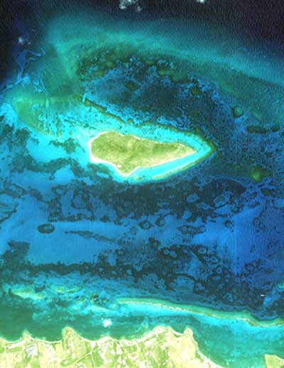
NOAA using commercial satellite to study coral reefs SPACE IMAGING NEWS RELEASE Posted: November 20, 2000 Space Imaging, the world's only company to offer commercially available one-meter satellite imagery, announced that the National Oceanic and Atmospheric Administration (NOAA, Washington, D.C.) and its partners in coral reef mapping have purchased more than $350,000 of CARTERRA imagery collected by the IKONOS satellite. The imagery will be used to map, measure and, potentially, monitor U.S. shallow-water coral reef ecosystems in the Caribbean and the Pacific Rim.
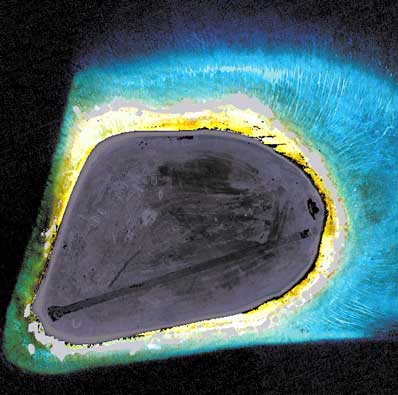
The Executive Order also established the U.S. Coral Reef Task Force. In March, the Task Force released a National Action Plan to Conserve Coral Reefs, which 'lays out a carefully considered, science-based road map to healthy coral reefs for generations to come.' Dr. Steve Rohmann, a physical scientist for NOAA, and colleagues from other federal, state, university and private organizations have nearly completed coral reef mapping activities in the U.S. Caribbean and are initiating similar activities in Hawaii, especially the northwest Hawaiian Islands. More than 60 percent of the United States' coral reef ecosystems are located in the Hawaiian archipelago. Of the estimated 17,000 square kilometers of coral reef areas in U.S. waters, only about eight percent have been meticulously mapped. Rohmann's project includes the use of IKONOS one-meter resolution panchromatic and four-meter resolution multispectral imagery to evaluate and map these areas. NOAA research has shown that IKONOS imagery has been found to have a depth penetration of up to 30 meters in clear water. "The IKONOS satellite can be pointed to minimize sun glint over water and maximize sunlight penetration and bottom feature visibility," said Rohmann. "That capability, combined with its spatial and spectral resolution, makes IKONOS a powerful tool in any effort to produce accurate, georeferenced maps of coral reef ecosystems."
Satellite technology from IKONOS holds promise for other coral reef-related activities. Monitoring the condition or health of coral reef ecosystems over time is an important application of high-resolution satellite imagery. Another untested use of high-resolution satellite imagery is the assessment of the impact of hazardous material spills and shipwrecks on coral reefs. Government-sponsored agencies, the media and consumers are beginning to realize that in the year since its launch, IKONOS has proven its use as a valuable tool for numerous applications. Some of the satellite's business applications include emergency response and rescue, agricultural mapping and planning, city planning, forestry, commercial and residential real estate, and a variety of uses in provincial, state and local government.
|
|
|||||