
Major Martian volcanoes surveyed by laser
SPACEFLIGHT NOW
Posted: September 5, 2000
NASA's Mars Global Surveyor spacecraft currently orbiting the Red Planet carries the Mars Orbiter Laser Altimeter instrument. MOLA transmits infrared laser pulses towards Mars and measures the time of flight to determine the range of the spacecraft to the surface below. Scientists can then use the measurements to develop a precise topographic map of the terrain.
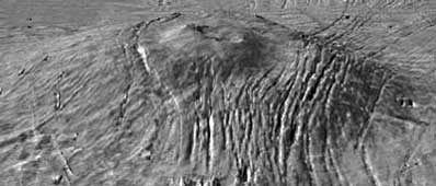
Two views of Alba Patera with topography draped over a Viking image mosaic. MOLA data have clarified the relationship between fault location and topography on and surrounding the Alba construct, providing insight into the volcanological and geophysical processes that shaped the edifice. The vertical exaggeration is 10:1. Photos: MOLA Science Team
|
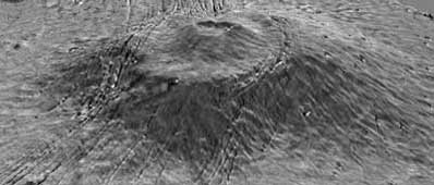
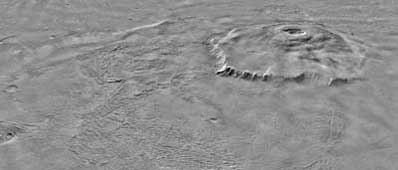
A pair of views of Arsia Mons, the southern most of the Tharsis montes, shown as topography atop a Viking image mosaic. MOLA topography clearly shows the caldera structure and the flank massive breakout that produced a major side lobe. The vertical exaggeration is 10:1. Photos: MOLA Science Team
|
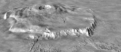
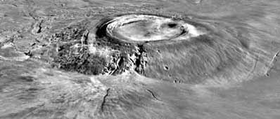
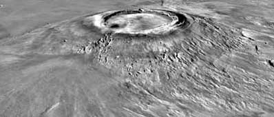
Olympus Mons as seen in two views with topography draped over a Viking image mosaic. MOLA's regional topography has shown that this volcano sits off to the west of the main Tharsis rise rather than on its western flank. The topography also clearly shows the relationship between the volcano's scarp and massive aureole deposit that was produced by flank collapse. The vertical exaggeration is 10:1. Photos: MOLA Science Team
|
|
|
|
|

|
