

|
|
|
|
|
|

|
|
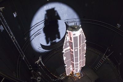
GOCE gravity-mapper drops closer to Earth for science BY STEPHEN CLARK SPACEFLIGHT NOW Posted: November 16, 2012 Europe's ion-powered GOCE satellite, devised to skim through the outer reaches of Earth's atmosphere, is lowering its altitude in a precarious attempt to map Earth's gravity field with unmatched precision.
The Gravity Field and Steady-State Ocean Explorer, or GOCE, was launched to measure tiny variations in gravity, allowing scientists to study changes in sea level and global ocean circulation. Three pairs of accelerometers mounted inside GOCE detect the tug of gravity as the satellite flies around Earth, mapping global changes in gravity's pull. "For us at ESA, GOCE has been a fantastic mission and it continues to surprise us," said Volker Liebig, ESA's director of Earth observation programs. "What the team of ESA engineers is now doing has not been done before and it poses a challenge. But it will also trigger new research in the field of gravity based on the high-resolution data we are expecting." GOCE flew in an unusual 255-kilometer, or 158-mile, polar orbit during its primary mission, using a low-thrust, high-efficiency ion engine to continuously pulse and keep the craft in orbit. Engineers want to limit use of chemical thrusters because they could disrupt GOCE's gravity studies. Thanks to a period of low solar activity and a contracting upper atmosphere, the satellite used less xenon gas than planned, leaving enough propellant to keep flying. European Space Agency officials extended the mission until the end of 2013. In August, engineers at the European Space Operations Center in Darmstadt, Germany, began commanding GOCE to lower its orbit by 300 meters, or about 1,000 feet, per day. Controllers paused the maneuvers in September to check the satellite's performance. GOCE has now resumed the orbit-lowering maneuvers and should reach a 146-mile-high orbit in February, ESA said in a statement issued Friday.
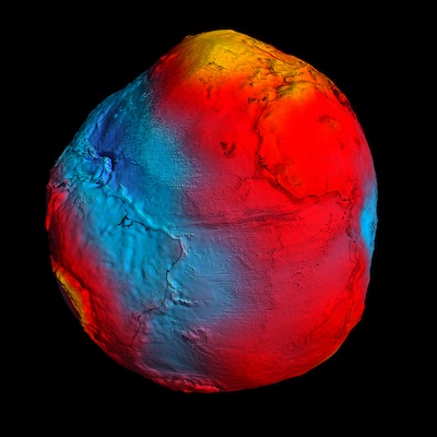
Despite GOCE's unique design, the satellite is susceptible to failures. Any disruption in the ion engine would cause GOCE to drop from orbit within a few weeks. "You don't have much time to react in case anything unexpected happens," Liebig told Spaceflight Now. "The air drag would force a re-entry relatively fast." Officials forecast GOCE will run out of xenon fuel around the end of 2013, hastening the end of its mission. Scientists hope data collected from GOCE's new orbit will shed light on smaller ocean dynamics, such as eddy currents, according to ESA. A three-dimensional global map produced from GOCE data, called a geoid, shows Earth's surface as influenced only by gravity - without the tug of ocean tides and currents. Geologists use the geoid as a reference for measurements of ocean currents, rising sea levels, and ice dynamics. "Oceanographers expect much better spatial resolution of gravity signals coming from ocean currents," Liebig said. ESA officials tout data already released from GOCE's earlier observations as the best satellite measurements ever made of Earth's gravity field. |
|
|
|
|
||||||||||||||||||||||||||||||||||||||||||||||||||||||||||||||||||||||||||||||||