

|
|
Satellite cameras catch startling glimpses of wrecked Japanese coastline from space
BY STEPHEN CLARK
SPACEFLIGHT NOW
Posted: March 14, 2011

Images from satellites circling hundreds of miles above Earth show widespread debris and flooded coastlines from the earthquake and tsunami that devastated northeastern Japan Friday.
The Japan Aerospace Exploration Agency, or JAXA, requested the activation of the International Charter on Space and Major Disasters, an agreement between satellite operators to provide remote sensing imagery during disasters.
A fleet of government and commercial satellites have been beaming back pictures of the catastrophe since Saturday.
Two satellites operated by GeoEye Inc. have collected dramatic images of flooded farms, inundated cities, burning debris and a train derailment in the hardest-hit region of Japan.
The Virginia-based company owns the 10-year-old Ikonos satellite and the GeoEye 1 spacecraft launched in 2008. The satellites produce images with resolutions of up to 39 inches and 16 inches, respectively.
Headquarted in Colorado, DigitalGlobe has three satellites in orbit snapping high-resolution imagery.
DigitalGlobe's satellite photos show a washed-out bridge, a decimated port and heavy damage at the Fukushima Daiichi nuclear power plant.
Lower-resolution images from NASA's Terra and Taiwan's Formosat 2 Earth observation satellites provide a broader view showing the scale of the calamity, including the extent of the tsunami's reach inland.
The 8.9-magnitude earthquake struck Friday afternoon, local time, about 80 miles offshore of Sendai, a large city on the northeast coast of Honshu, Japan's largest island.
The jolt triggered a deadly tsunami that reached the Japanese coast minutes later, engulfing communities and leaving a wake of destruction.

See a larger image from a DigitalGlobe satellite showing the Fukushima Daiichi nuclear power plant minutes after another explosion rocked the facility, threatening to release more radiation into the atmosphere. This image was collected at 11:04 a.m. Japan Standard Time on Monday, March 14. Photo credit: DigitalGlobe

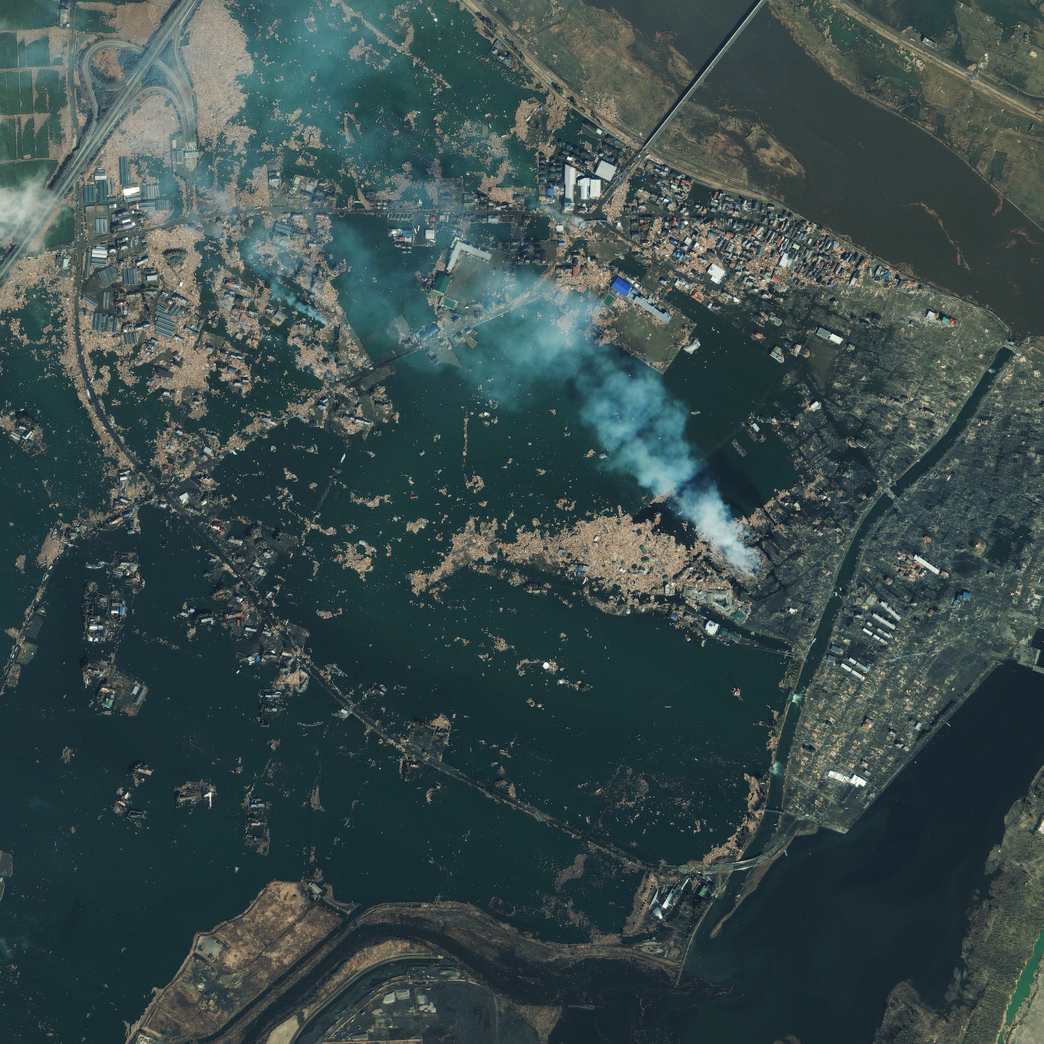
See a larger image from GeoEye's Ikonos satellite captured March 12. The photo shows flooded fields and burning debris in Natori, a city of more than 70,000 people in Miyagi prefecture near Sendai. Photo credit: GeoEye
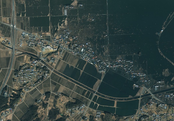
This image captured by GeoEye's Ikonos satellite March 12 shows inundated land near the Japanese coast in Minamisanrikucho, a small city north of Sendai in Miyagi prefecture. Photo credit: GeoEye
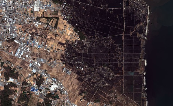
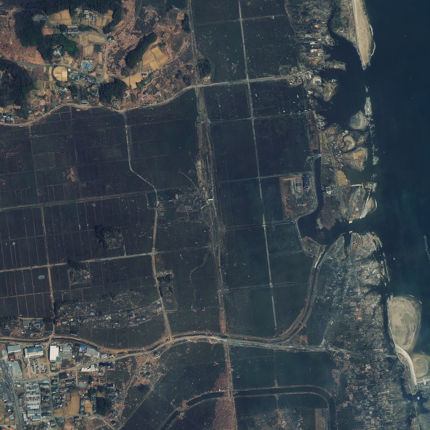
This image from a DigitalGlobe satellite illustrates the reach of the devastating tsunami that struck Minamisoma in Fukushima prefecture. The water in this image from March 12 reached 1.5 miles from the coast, according to DigitalGlobe. Photo credit: DigitalGlobe
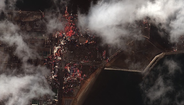
This image from a DigitalGlobe satellite is of the port of Sendai, a large city of about 1 million residents. The photo shows cargo strewn across the port in the aftermath of the earthquake and tsunami. Photo credit: DigitalGlobe

See a larger image from the GeoEye 1 satellite of a train overwhelmed by the raging tsunami in Shinchi in Fukushima prefecture. The train is one of four Japanese rail officials lost contact with in the wake of the catastrophe. Photo credit: GeoEye

See a larger image from the Formosat 2 satellite operated by Taiwan's National Space Organization. Formosat 2's image shows tsunami waters reaching more than 4 kilometers, or 2.5 miles, inland near Iwanuma in Miyagi prefecture. Photo credit: NSPO
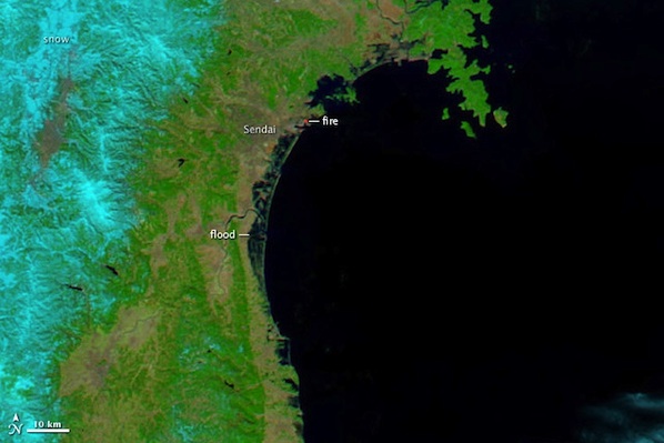
This image from NASA's Terra satellite shows the extent of the tsunami waters as they pummeled the Japanese coast near Sendai. Terra acquired this image around 10:30 a.m. Japan Standard Time on March 12. Photo credit: NASA
|
|
-->

