|
|
|
|
|
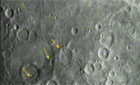
Landing site viewed through eyes of future moon crew NASA/JPL NEWS RELEASE Posted: February 28, 2008 PASADENA, Calif. - NASA has obtained the highest resolution terrain mapping to date of the moon's rugged south polar region, with a resolution to 20 meters (66 feet) per pixel. Scientists at NASA's Jet Propulsion Laboratory, Pasadena, Calif., collected the data using the Deep Space Network's Goldstone Solar System Radar located in California's Mojave Desert. The imagery generated by the data has been incorporated into animation depicting the descent to the lunar surface of a future human lunar lander and a flyover of Shackleton Crater. The mapping data collected indicate that the region of the moon's south pole near Shackleton Crater is much more rugged than previously understood. The Shackleton rim area is considered a candidate landing site for a future human mission to the moon. "The south pole of the moon certainly would be a beautiful place to explore," said Doug Cooke, deputy associate administrator for the Exploration Systems Mission Directorate at NASA Headquarters, Washington. "We now know the south pole has peaks as high as Mt. McKinley and crater floors four times deeper than the Grand Canyon. There are challenges that come with such rugged terrain, and these data will be an invaluable tool for advance planning of lunar missions." Three times during a six-month period in 2006, scientists targeted the moon's south polar region using Goldstone's 70-meter (230-foot) radar dish. The antenna, three-quarters the size of a football field, sent a 500-kilowatt-strong, 90-minute-long radar stream 373,046 kilometers (231,800 miles) to the moon. The radar bounced off the rough-hewn lunar terrain over an area measuring about 644 kilometers by 402 kilometers (400 miles by 250 miles). Signals were reflected back to two of Goldstone's 34-meter (112-foot) antennas on Earth. The roundtrip time, from the antenna to the moon and back, was about two-and-a-half seconds. "I have not been to the moon, but this imagery is the next best thing," said Scott Hensley, a scientist at JPL and lead investigator for the study. "With these data we can see terrain features as small as a house without even leaving the office." Previously, the best resolution of the moon's south pole was generated by the Clementine spacecraft, which could resolve lunar terrain features near the south pole at 1 kilometer (0.6 miles) per pixel. The new resolution generated by JPL is 50 times more detailed. NASA's Lunar Reconnaissance Orbiter will provide the next generation of lunar imaging and data. The spacecraft is scheduled to launch in late 2008. The Lunar Reconnaissance Orbiter Camera will retrieve high-resolution images of the moon's surface and lunar poles with resolutions to 1 meter (3.3 feet). These images will provide knowledge of polar illumination conditions, identify potential resources and hazards, and enable safe landing site selection. Other instruments aboard the orbiter will return data such as temperature maps, ultraviolet images, characterization of radiation on the moon and a high-resolution 3-D map. NASA's quest for up-to-date imagery of the moon also will benefit from international missions such as Japan's Selene robotic probe. Funding for the program was provided by NASA's Exploration Systems Mission Directorate. |
|
|
|
|||||||||||||||||||||