|
|
||
|
|
|
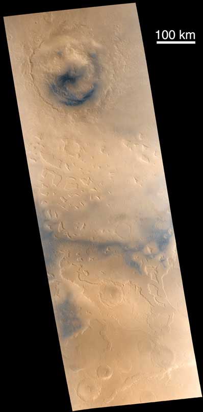
Take a peek at the Red Planet's fretted terrain NASA/JPL/MSSS PHOTO RELEASE Posted: February 3, 2001 Martian "fretted terrain" occurs in regions of buttes and mesas that stand at the erosional margin where northern low-lying plains meet the higher-standing cratered uplands. Found mostly in the mid-northern latitudes, some of the best examples of fretted terrain occur in Deuteronilus Mensae, as seen here.
Part of that effort requires us to acquire compositional information -- from the Mars Global Surveyor Thermal Emission Spectrometer (TES), from the Thermal Infrared Mapping Spectrometer (THEMIS) and Gamma Ray Spectrometer (GRS) on the 2001 Mars Odyssey mission, and from color images such as these taken by Mars Global Surveyor's Mars Orbiter Camera. Subtle and not-so-subtle color variations seen in this composite of MOC images M23-01279 and M23-01280 (acquired January 19, 2001) trace both the movement of dark sand of possible volcanic origin and fresh, dark outcrops of unweathered bedrock. Malin Space Science Systems and the California Institute of Technology built the MOC using spare hardware from the Mars Observer mission. MSSS operates the camera from its facilities in San Diego, CA. The Jet Propulsion Laboratory's Mars Surveyor Operations Project operates the Mars Global Surveyor spacecraft with its industrial partner, Lockheed Martin Astronautics, from facilities in Pasadena, CA and Denver, CO.
|
|
||||