|
|
||
|
|
|
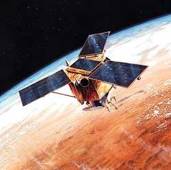
Top 10 images released from commercial eye-in-the-sky SPACE IMAGING NEWS RELEASE Posted: September 25, 2000
Since Jan. 1, 2000, when Ikonos imagery was first made available for sale to customers, the Ikonos satellite has logged many milestones. It has:
In celebration of this anniversary, Space Imaging is showcasing 10 of the year's most visually striking Ikonos photographs on the company's Web site. These images show the Great Pyramids of Egypt; California's Hollywood sign; the Olympic Park venue in Sydney, Australia; Hoover Dam; London's Millennium Wheel; San Francisco Harbor; Hong Kong Harbor; Mecca, Saudi Arabia; and a before and after of the bombing of Grozny, Chechnya. Ikonos imagery has affected the lives and livelihoods of people, businesses and governments around the world. Space Imaging recently worked with Los Alamos National Laboratory in Los Alamos, N.M., following the destructive wildfires that blazed through this city early last summer. Los Alamos bought high-resolution Ikonos satellite imagery to survey vegetation and structural damage caused by the Cerro Grande fire and to help plan erosion mitigation for any possible flooding caused by the loss of vegetation cover. Ikonos imagery has benefited other groups:
"Ikonos was built to provide new information capabilities for business and government to use for decision making," said John Copple, CEO of Space Imaging. "The information capabilities of the Ikonos system surpassed both the industry's and our own expectations." Copple continued, "I am extremely proud of the accomplishments of our employees and our suppliers to make this technology available to the commercial marketplace. What Ikonos has produced in the past year is just the beginning of what's to come as we move forward into the visual information age."
|
|
|||||