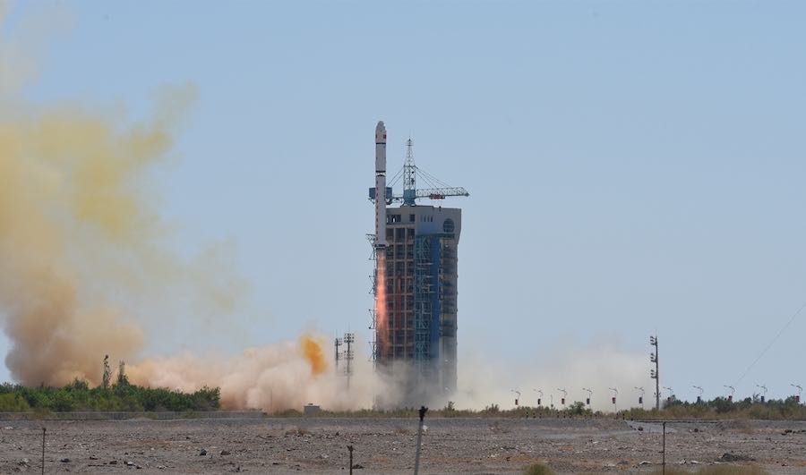
China successfully launched a Long March 2D rocket July 29 with a Tianhui military satellite on a mission to collect data for maps and land surveys.
China’s largest state-owned space program contractor said the Tianhui 1-04 satellite launched at 0401 GMT (12:01 a.m. EDT) on July 29 from the Jiuquan space center in the Gobi Desert of northwestern China.
The 13-story Long March 2D rocket fired off its launch pad with around 650,000 pounds of thrust from four hydrazine-fueled main engines. The Long March 2D’s second stage took over a few minutes after liftoff, completing a burn to inject its payload into orbit.
Chinese officials declared the launch a success, and independent orbital tracking data published by the U.S. military indicated the rocket deployed its satellite in a near-circular orbit about 300 miles (500 kilometers) above Earth at an inclination of 97.5 degrees.
The Tianhui 1-04 payload is the sixth in China’s series of Tianhui mapping satellites, joining three similar first-generation spacecraft and two new-generation Tianhui satellites.
The China Aerospace Science and Technology Corp., or CASC, said in a statement that the Tianhui 1-04 spacecraft will conduct land and resource surveys, collect data to create and global update maps, and perform scientific research. The satellite is believed to carry multiple cameras, including stereo instruments to generate three-dimensional maps.
The spacecraft was built by Aerospace Dongfanghong Satellite Co. Ltd., a subsidiary of CASC.
Email the author.
Follow Stephen Clark on Twitter: @StephenClark1.