An upgraded NOAA weather satellite has entered service after a year of checkouts to provide critical, rapidly-refreshed imagery to forecasters in time for next year’s severe storm and hurricane seasons in the United States and the Atlantic Ocean.
NOAA announced Monday that the GOES-16 spacecraft began regular weather observations after ground controllers maneuvered the satellite to its new operating position in geostationary orbit nearly 22,300 miles (35,800 kilometers) over the equator at 75.2 degrees west longitude.
GOES-16 replaces the GOES-13 satellite in NOAA’s GOES-East position, which covers the eastern United States and the Atlantic Ocean. Spacecraft in geostationary orbit orbit the Earth at the same rate of the planet’s rotation, making it a popular location to enable communications and weather satellites to cover the same geographic location 24 hours a day.
Meteorologists got a taste of GOES-16’s capabilities last year, when NOAA offered imagery from the new satellite on an experimental basis. The higher-resolution, more timely imagery can now be incorporated into regular forecasts.
“GOES-16 has proven to be one of the most important tools we’ve ever developed for our weather and hazard forecasts,” said retired U.S. Navy Rear Adm. Timothy Gallaudet, acting NOAA administrator. “From its impressive first image of Earth last January to monitoring tropical storms and wildfires, GOES-16 has and will continue to greatly improve our ability to visualize potential threats, and enhance forecasts and warnings to save lives and protect property.”
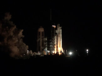
GOES-16 launched Nov. 19, 2016, from Cape Canaveral on top of a United Launch Alliance Atlas 5 rocket, then boosted itself into a circular geostationary orbit for a year of testing.
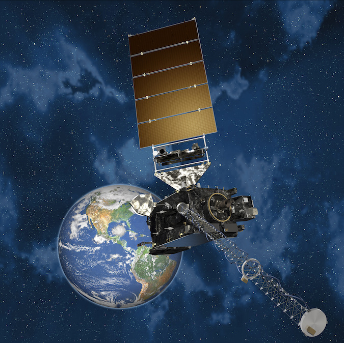
Ground controllers took extra time to verify the performance of GOES-16 because it is the first of a new, modernized generation of GOES weather satellites. Built by Lockheed Martin, GOES-16 carries a high-performance camera called the Advanced Baseline Imager, plus a lightning mapper and sensors to monitor solar activity and space weather.
The Advanced Baseline Imager includes 16 imaging filters to take pictures of hurricanes and storm systems in visible and infrared light, an improvement from five imaging channels available on previous GOES satellites.
GOES-16 is NOAA’s first geostationary weather satellite to carry a lightning detector.
“We are using the GOES-16 data in ways we planned and in ways we didn’t even imagine,” said Louis Uccellini, director of the National Weather Service. “GOES-16 has been a game changer for monitoring hurricanes, wildfires, severe storms, and lightning. Now that it is operational and the data is incorporated into the forecast process, we will be able to use it across all our service areas, starting with winter storms.”
The richer data from new GOES weather satellites — starting with GOES-16 — allow meteorologists to distinguish between snow, fog, clouds, volcanic ash, and other particles suspended in the atmosphere. During GOES-16’s test phase, forecasters tracked multiple hurricanes churning through the Atlantic, the Gulf of Mexico and the Caribbean Sea, including Harvey, Irma, Jose and Maria.
Officials said GOES-16 helped predict how much flooding rainfall would be produced by Hurricane Harvey as it drifted over the Texas coast, helped spot wildfires in California, Kansas, Oklahoma and Texas, and improved air quality forecasts.
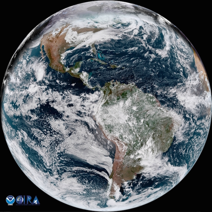
GOES-16’s primary scanning camera offers views of hurricanes and regions with active weather as often as every 30 seconds. The ABI can operate in several modes, including one to take a full disk image showing most of the Western Hemisphere every 15 minutes and a zoomed-in view of the continental United States every five minutes, while simultaneously tracking a hurricane with better resolution and quicker updates.
The previous generation of GOES satellites take a full disk image of the Western Hemisphere every 30 minutes, collect a U.S. view every 15 minutes, and provide updates on a storm’s strength and position every five minutes, but not at the same time.
The next member of the new GOES satellite series — GOES-S, to be renamed GOES-17 after launch — is being readied for liftoff on an Atlas 5 rocket from Cape Canaveral on March 1. It will enter service late next year in the GOES-West position, replacing an earlier satellite with a view of the Pacific Ocean and the western United States.
NOAA operates weather satellites in the GOES-East and GOES-West positions, and maintains at least one backup observatory ready to replace one of the primary spacecraft in case of a failure, ensuring uninterrupted coverage of the Western Hemisphere from Guam to the west coast of Africa.
The GOES-13 satellite is expected to be moved to a standby location now that GOES-16 is operational in the GOES-East slot.
Two more Lockheed Martin-built GOES satellites are scheduled for launch in 2020 and 2024.
The modernized four-satellite weather network is expected to cost nearly $11 billion when complete, including NOAA’s purchase of the spacecraft, launch services, instruments and upgrades to ground systems.
Email the author.
Follow Stephen Clark on Twitter: @StephenClark1.