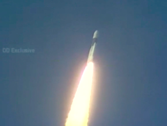
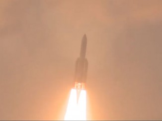
The third satellite for India’s regional navigation network is set for liftoff Wednesday to join a growing fleet of spacecraft providing independent tracking and positioning services over India and its neighbors.
Set for liftoff at 2002 GMT (4:02 p.m. EDT) Wednesday, a Polar Satellite Launch Vehicle will propel the 3,142-pound (1,425-kilogram) spacecraft into orbit from the Satish Dhawan Space Center, India’s primary space launch site on the country’s eastern coastline about 50 miles north of Chennai.
The launch window, which opens at 1:32 a.m. local time Thursday, extends for 15 minutes, according to the Indian Space Research Organization.
The launcher will fly in the PSLV XL configuration powered by a solid-fueled first stage and six enlarged strap-on rocket motors to give the launcher an extra boost.
A hydrazine-burning Vikas second stage engine, a solid-fueled third stage, and a fourth stage kick engine consuming liquid propellants will finish the job.
It will take about 20 minutes for the four-stage PSLV to put the navigation satellite into an egg-shaped transfer orbit stretching from 176 miles (284 kilometers) to 12,831 miles (20,650 kilometers) above Earth tilted at an angle of 17.9 degrees to the equator.
An update posted to ISRO’s website Tuesday said prelaunch activities were progressing normally after the PSLV’s 67-hour countdown started Monday.
The spacecraft set for launch Wednesday is the third member of the Indian Regional Navigation Satellite System, a network that will eventually consist of seven satellites by the end of 2015 to broadcast position information to military and civilian users across India and extending up to 900 miles from the nation’s borders.
Designed for a 10-year lifetime, the IRNSS 1C satellite will join two navigation satellites launched in July 2013 and in April. A fourth Indian navigation payload is set for liftoff as soon as December.
The satellite will extend two power-generating solar arrays soon after reaching orbit, then an on-board rocket engine will circularize the spacecraft’s orbit about 22,300 miles above Earth.
In that position, IRNSS 1C will be locked over the equator at 83 degrees east longitude.
The Indian navigation system will include three satellites in equatorial geostationary orbits and four spacecraft in inclined orbits that swing up to 29 degrees north and south of the equator.
India’s satellite navigation network works like the U.S. military’s Global Positioning System, using multiple spacecraft to triangulate a user’s position on Earth by measuring the time it takes to transmit and receive radio signals between space and the ground.
But the Indian satellite constellation is focused on South Asia and neighboring waters.
Indian officials say the independent navigation service will aid marine traffic, emergency response officials, vehicle tracking applications, mobile communications, mapping, and civilian drivers.
India joins the United States, Russia, China, Europe and Japan in fielding their own space-based navigation systems for global or regional coverage.